File list
This special page shows all uploaded files.
| Name | Thumbnail | Size | User | Description | Versions | |
|---|---|---|---|---|---|---|
| 13:12, 12 May 2014 | Exhibit3-BfAf-Flooding-640x480.jpg (file) |  |
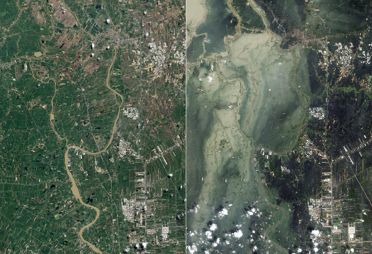
154 KB | TSP | Exhibit 3: Satellite photographs showing flooding in Ayutthaya and Pathum Thani Provinces in July 2011 (left, before the flooding) and October 2011 (right, after the flooding) Source: http://en.wikipedia.org/wiki/2011_Thailand_floods | 1 |
| 13:11, 12 May 2014 | Exhibit2-RID-strategy-map-640x480.png (file) |  |
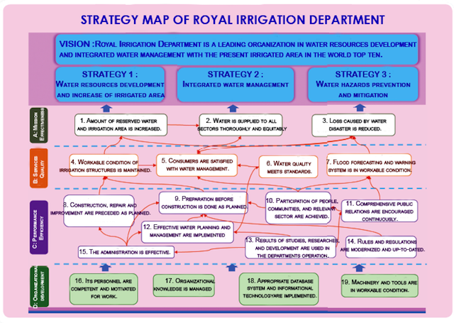
304 KB | TSP | Exhibit 5b: Strategy Map of Thailand’s Royal Irrigation Department Source: http://www.rid.go.th/ | 1 |
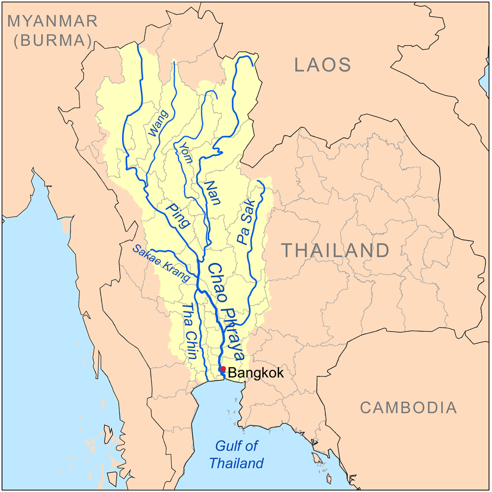
| 13:09, 12 May 2014 | Exhibit1-CPRB-Map-640x480.png (file) |  |
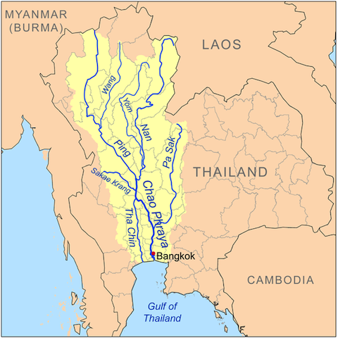
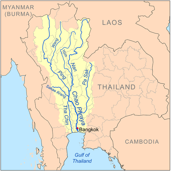
211 KB | TSP | Exhibit 1: The Chao Phraya River and its Tributaries Source: http://en.wikipedia.org/wiki/Tributaries_of_the_Chao_Phraya_River | 1 |
| 22:47, 10 May 2014 | Xx-7.jpg (file) |  |
170 KB | TSP | Satellite photographs showing flooding in Ayutthaya and Pathum Thani Provinces in July 2011 (left, before the flooding October 2011) and October 2011 (right, after the flooding in July) Source: http://en.wikipedia.org/wiki/2011_Thailand_floods | 1 |
| 22:46, 10 May 2014 | 7.jpg (file) |  |
419 KB | TSP | 2011 Thailand Flood Satellite Photo Source: http://en.wikipedia.org/wiki/2011_Thailand_floods | 1 |
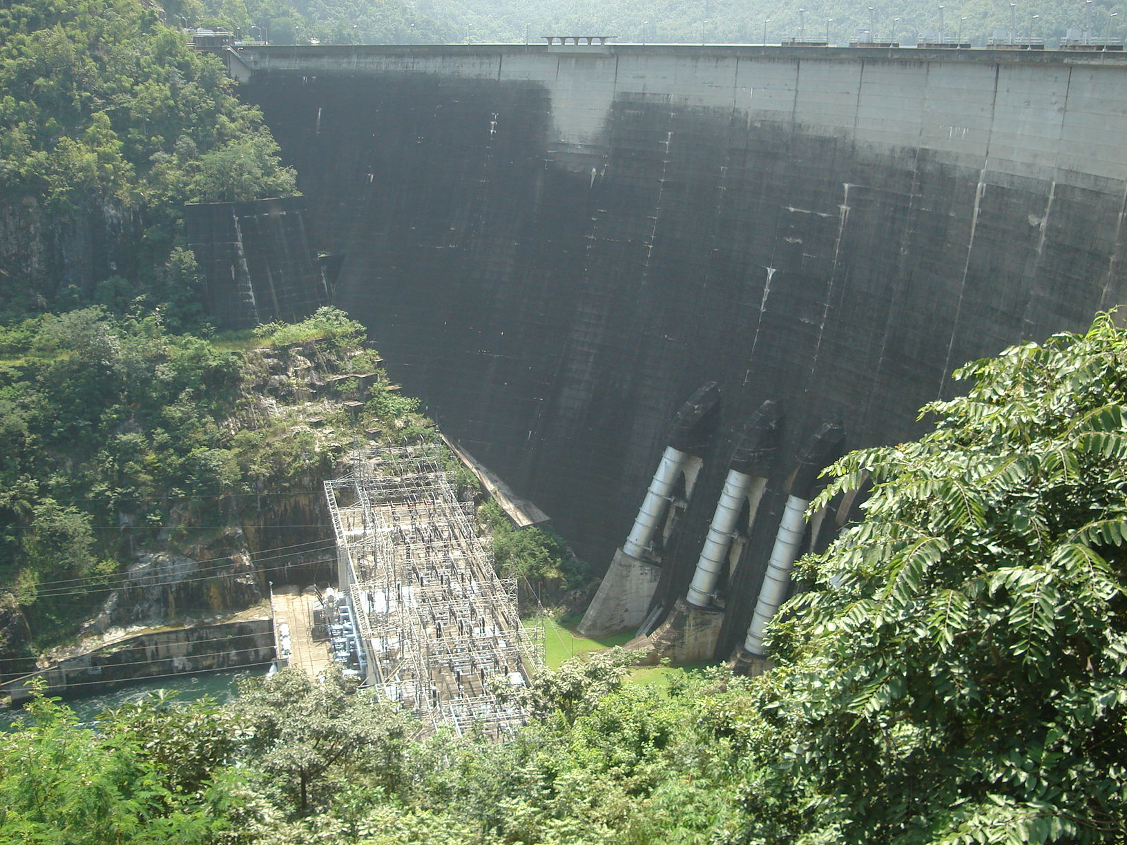
| 22:17, 10 May 2014 | Xx-Bhumibol dam front.jpg (file) |  |
132 KB | TSP | Bhumipol Dam Source: http://en.wikipedia.org/wiki/Bhumibol_Dam | 1 |
| 22:10, 10 May 2014 | Xx-Chaophrayarivermapxx.png (file) |  |
233 KB | TSP | The Chao Phraya River and its Tributaries Source: http://en.wikipedia.org/wiki/Tributaries_of_the_Chao_Phraya_River | 1 |
| 21:03, 30 April 2014 | Bhumibol dam front.jpg (file) |  |
490 KB | TSP | Exhibit 3: Bhumipol Dam Source: http://en.wikipedia.org/wiki/Bhumibol_Dam | 1 |
| 21:02, 30 April 2014 | Wat Arun.jpg (file) |  |
42 KB | TSP | Wat Arun, viewed from Chao Phraya River http://en.wikipedia.org/wiki/Chao_Phraya_River | 1 |
| 21:01, 30 April 2014 | Chaophrayarivermap.png (file) |  |
391 KB | TSP | The Chao Phraya River and its Tributaries Source: http://en.wikipedia.org/wiki/Tributaries_of_the_Chao_Phraya_River | 1 |
| 21:27, 28 April 2014 | IRD strategy-map.png (file) |  |
121 KB | TSP | 2 |


