File list
This special page shows all uploaded files.
| Date | Thumbnail | Size | User | Description | Versions | |
|---|---|---|---|---|---|---|
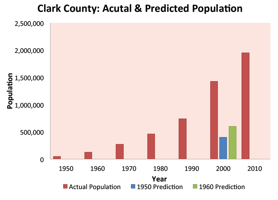
| 14:48, 14 May 2013 | Clark County Population Growth 1950 - 2010.png (file) |  |
31 KB | Amanda | Graphic Produced by Margaret Garcia for Water Competition & Cooperation in the Las Vegas Valley | 1 |
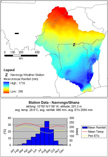
| 19:42, 23 March 2012 | Climatic Data.jpg (file) |  |
47 KB | Administrator | Climatic Data for Volta River Basin | 1 |
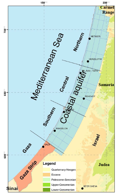
| 09:20, 26 June 2014 | Coastal-Aquifer-Extent.png (file) |  |
210 KB | Amanda | low-res Image showing the extent of the Coastal Aquifer. This image is figure 17 in : Weinberger, G. et al. 2012. The Natural Water Resources between the Meditteranean Sea and the Jordan River. Israel Hydrologic Service. Jerusalem. online: http://www.... | 1 |
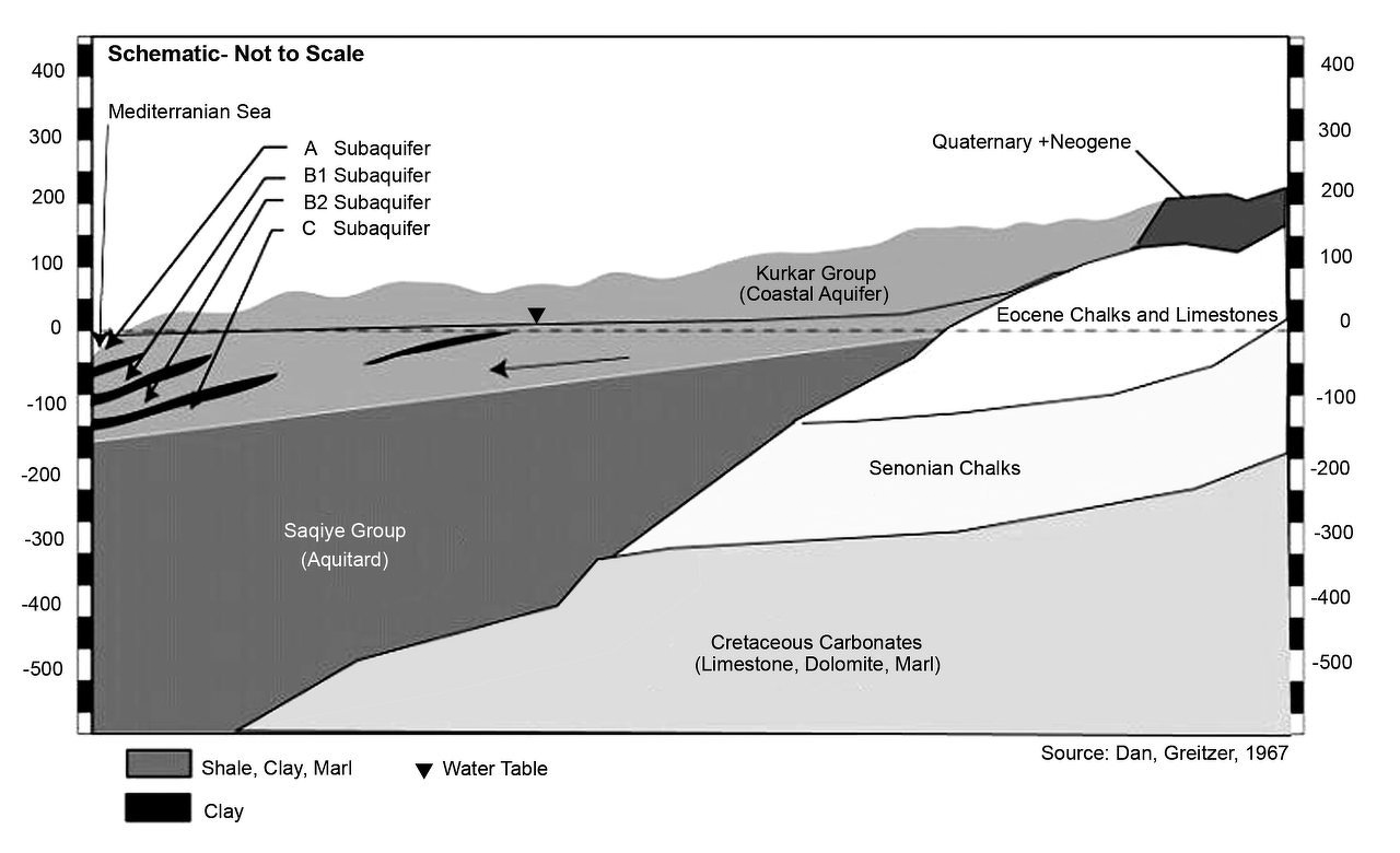
| 10:06, 26 June 2014 | Coastal-Aquifer-Schematic.png (file) |  |
393 KB | Amanda | Geologic Schematic of the Coastal Aquifer from: Greitzer, D. J. Dan. 1967, The effect of soil landscape and quaternary geology on the distribution of saline and freshwater aquifers in the Coastal Plain of Israel, Water Planning for Israel, Tel Aviv, L... | 1 |
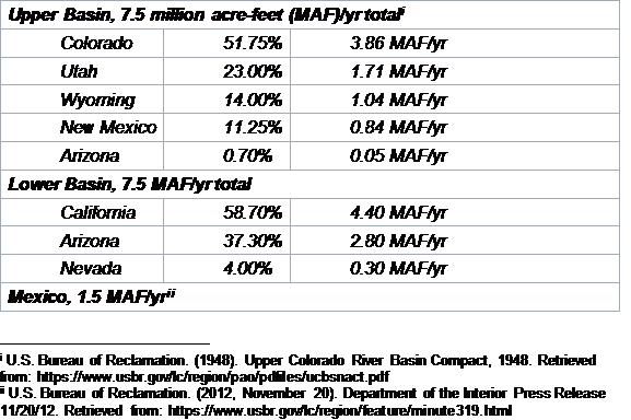
| 10:23, 25 May 2017 | ColoradoRiver Allocations.png (file) |  |
25 KB | Keefe | 1 | |
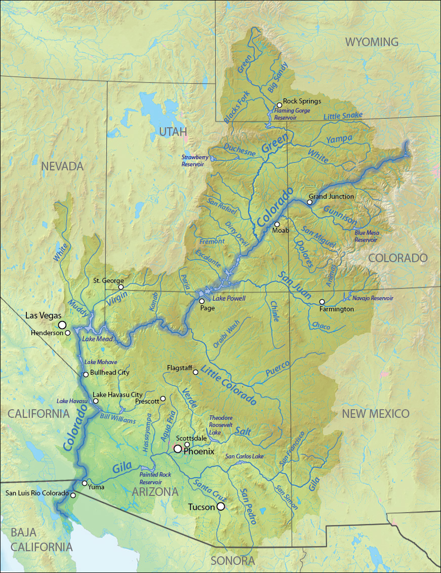
| 14:09, 16 May 2013 | Coloradorivermapnew1.jpg (file) |  |
701 KB | Amanda | Author: Wikimedia Commons user Shannon [GFDL (http://www.gnu.org/copyleft/fdl.html) or CC-BY-SA-3.0-2.5-2.0-1.0 (http://creativecommons.org/licenses/by-sa/3.0)], via Wikimedia Commons Background and river course data from http://www2.demis.nl/mapserver/m | 1 |
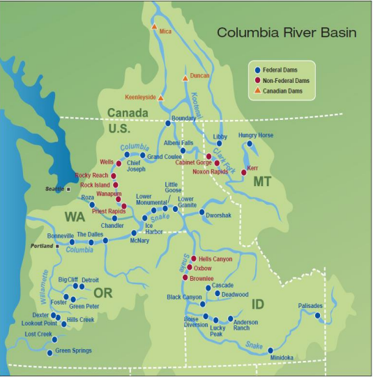
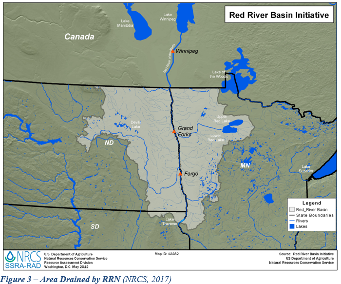
| 13:39, 18 May 2017 | Columbia River Basin.png (file) |  |
412 KB | Yanisa | Source: Bonneville Power Administration | 1 |
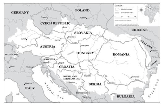
| 14:20, 27 July 2012 | DanudeRiverBasin.jpg (file) |  |
28 KB | Mpritchard | Map of the Danube River Basin “Product of the Transboundary Freshwater Dispute Database, Department of Geosciences, Oregon State University. Additional information about the TFDD can be found at: <http://www.transboundarywaters.orst.edu>.” | 1 |
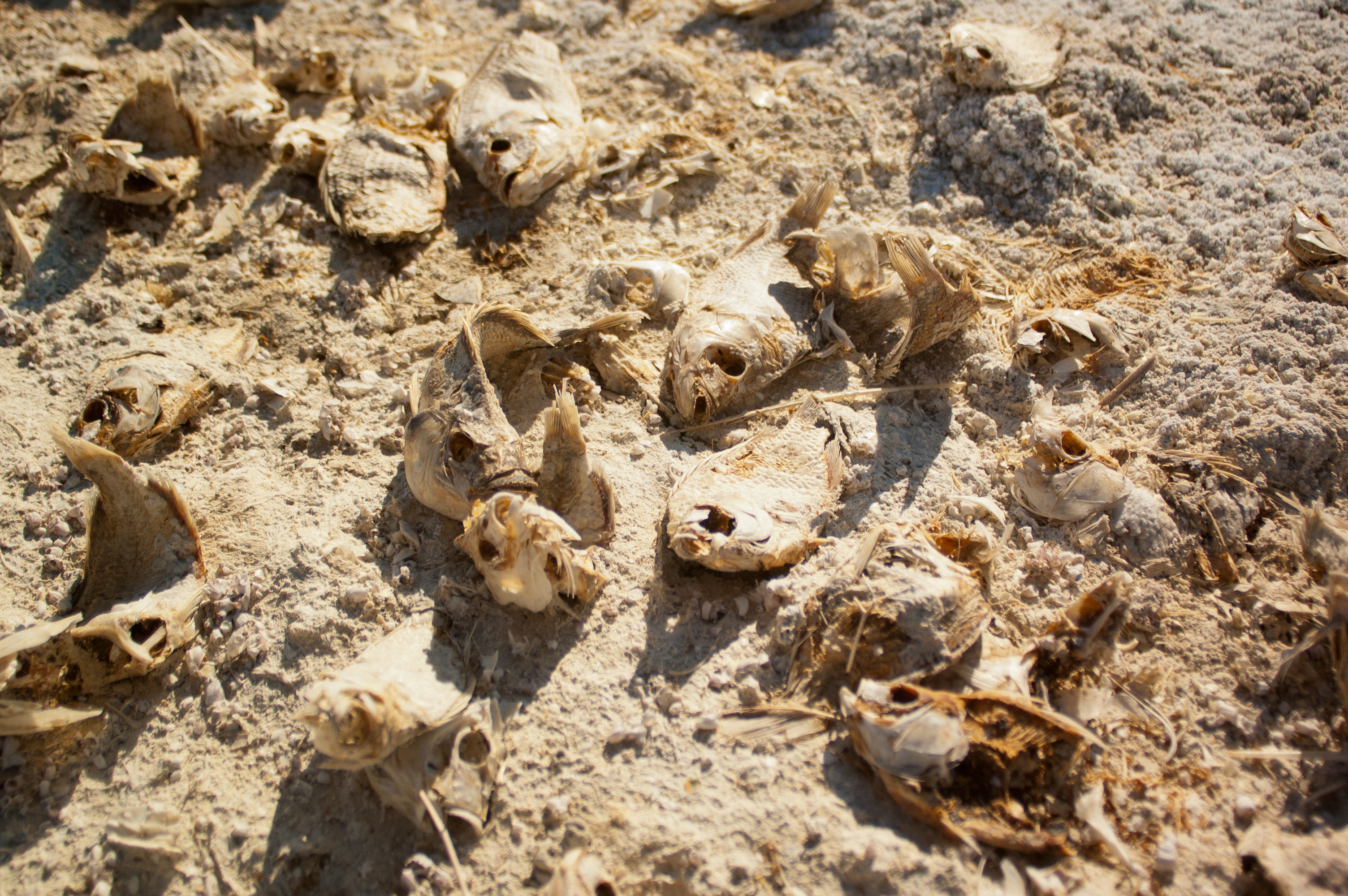
| 17:02, 18 January 2016 | DeadFish.jpg (file) |  |
5.02 MB | JRozek | Source: https://www.flickr.com/photos/hermitsmoores/6578846137/ License: https://creativecommons.org/licenses/by-nc-sa/2.0/ | 1 |
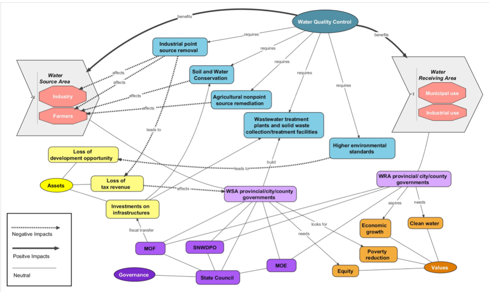
| 08:14, 6 June 2012 | Deangelis and Wang Network MRP 2012.jpg (file) |  |
460 KB | Amanda | A Network Representation Diagram for Water Quality Control on South-to-North Water Diversion (SNWD) Middle Route Project (MRP) Case Study (2012). Yuan Wang and Kelly DeAngelis. Created May 2012. Prepared for Water Diplomacy Seminar III at Tufts Universi | 1 |
| 19:43, 23 March 2012 | Dominant Variables.jpg (file) |  |
22 KB | Administrator | Dominant Variable for Volta River Basin Case Study | 1 |
| 21:42, 23 May 2014 | Drainage.png (file) |  |
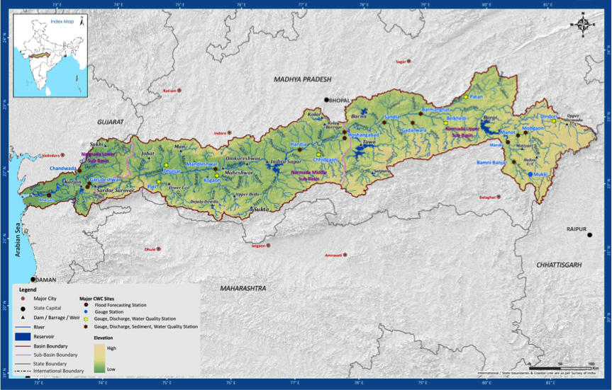
720 KB | Rachel | Narmada Basin and Sub-basin Drainage, incl. Reservoirs (submergence areas) | 1 |
| 22:36, 26 March 2012 | During Partition.jpg (file) |  |
68 KB | Administrator | 1 | |
| 17:17, 21 December 2015 | Ethiopia Highlands.jpg (file) |  |
8.05 MB | Agustinbotteron | 1 | |
| 13:09, 12 May 2014 | Exhibit1-CPRB-Map-640x480.png (file) |  |
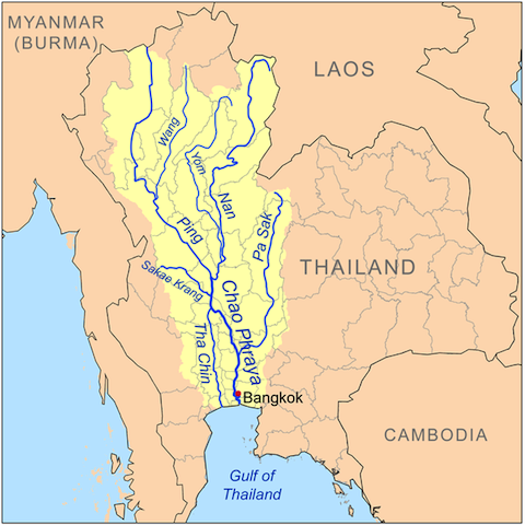
211 KB | TSP | Exhibit 1: The Chao Phraya River and its Tributaries Source: http://en.wikipedia.org/wiki/Tributaries_of_the_Chao_Phraya_River | 1 |
| 13:11, 12 May 2014 | Exhibit2-RID-strategy-map-640x480.png (file) |  |
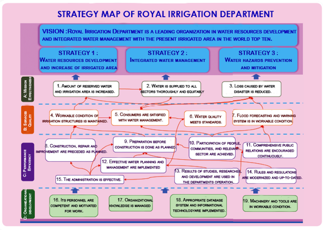
304 KB | TSP | Exhibit 5b: Strategy Map of Thailand’s Royal Irrigation Department Source: http://www.rid.go.th/ | 1 |
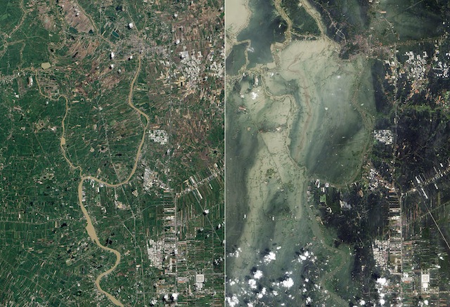
| 13:12, 12 May 2014 | Exhibit3-BfAf-Flooding-640x480.jpg (file) |  |
154 KB | TSP | Exhibit 3: Satellite photographs showing flooding in Ayutthaya and Pathum Thani Provinces in July 2011 (left, before the flooding) and October 2011 (right, after the flooding) Source: http://en.wikipedia.org/wiki/2011_Thailand_floods | 1 |
| 15:01, 16 July 2012 | External link icon.png (file) | 8 KB | Amanda | background removed | 2 | |
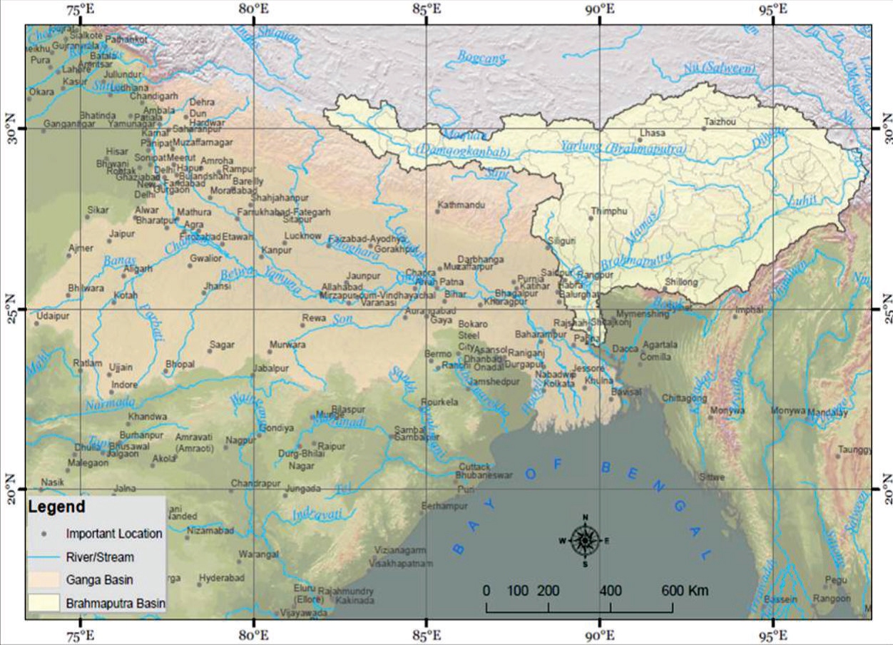
| 16:16, 23 May 2017 | Fig 1. The Brahmaputra sub-basin in South Asia.jpg (file) |  |
536 KB | Cindynoe | 1 | |
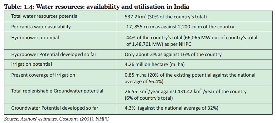
| 16:40, 23 May 2017 | Fig 4. Water Resources - Availability and Utilization in India.jpg (file) |  |
101 KB | Cindynoe | 1 | |
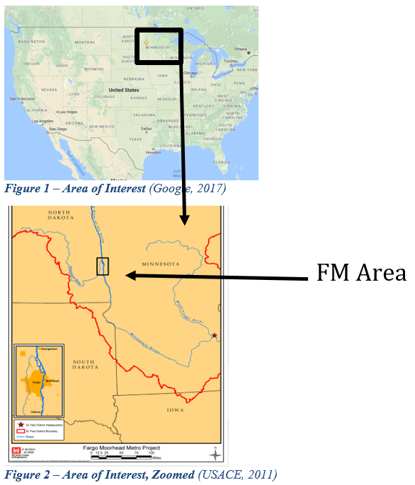
| 19:59, 6 June 2017 | Figure 3.PNG (file) |  |
565 KB | Gtbrien | 3 | |
| 20:00, 6 June 2017 | Figure 4.PNG (file) |  |
218 KB | Gtbrien | 3 | |
| 20:00, 6 June 2017 | Figure 5.PNG (file) |  |
422 KB | Gtbrien | 3 | |
| 20:01, 6 June 2017 | Figure 6.PNG (file) |  |
431 KB | Gtbrien | 3 | |
| 20:01, 6 June 2017 | Figure 7.PNG (file) |  |
376 KB | Gtbrien | 3 | |
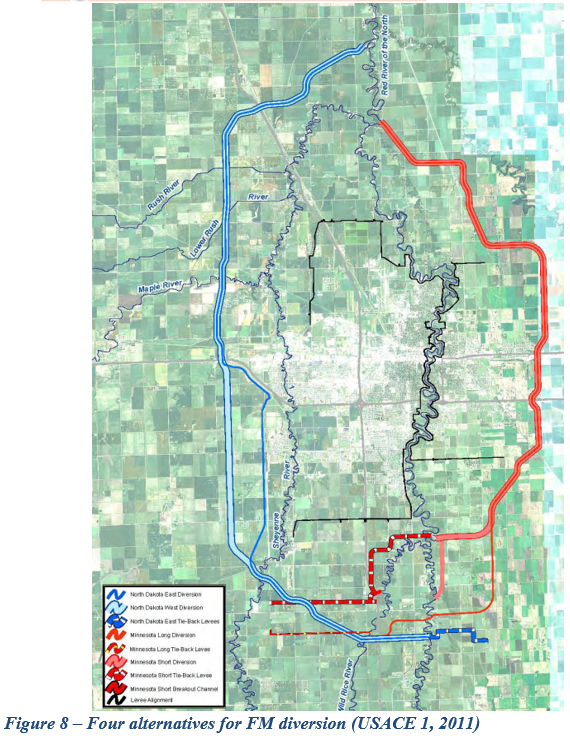
| 20:02, 6 June 2017 | Figure 8.PNG (file) |  |
978 KB | Gtbrien | 3 | |
| 20:02, 6 June 2017 | Figures 1 and 2.PNG (file) |  |
188 KB | Gtbrien | 4 | |
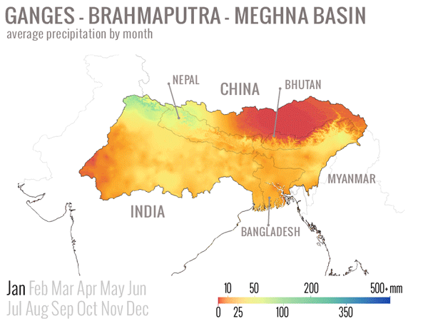
| 08:29, 18 March 2014 | GBM monthly average precip.gif (file) |  |
335 KB | Amanda | animated .GIF illustrating average monthly precipitation values in the Ganges-Brahmaputra-Meghna Basin (India, Nepal, China (Tibet), Bhutan, Bangladesh, Myanmar) Precipiation values from 30 arc-second World Clim global data set. Interpolated average p... | 1 |
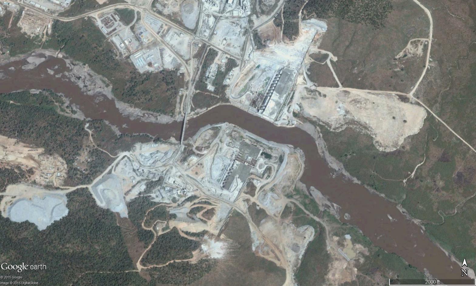
| 16:26, 21 December 2015 | GERD Site.jpg (file) |  |
895 KB | Agustinbotteron | Site of construction of the Grand Ethiopian Renaissance Dam (GERD), Ethiopia. | 1 |
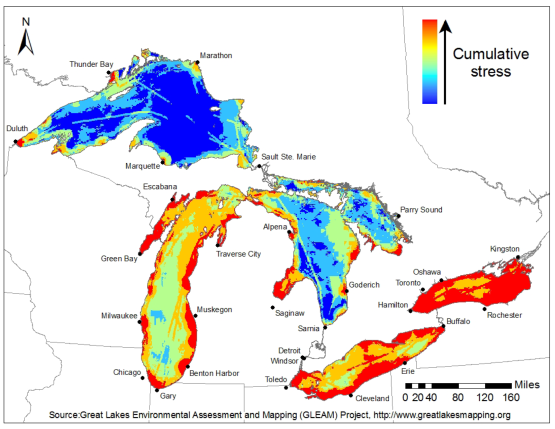
| 11:56, 16 May 2014 | GLEAM Great Lakes Environmental Stress Map.png (file) |  |
169 KB | Amanda | Great Lakes Environmental Stress Map, 2012. This is a product of the Great Lakes Environmental Assessment and Mapping (GLEAM) Project. http://www.greatlakesmapping.org/ Additional maps, descriptive documents, and other resources may be found here: ... | 1 |
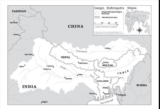
| 12:13, 30 July 2012 | GangesBasin.jpg (file) |  |
21 KB | Mpritchard | Map of the Ganges- Brahmaputra-Megna basin (TFDD, 2012).“Product of the Transboundary Freshwater Dispute Database, Department of Geosciences, Oregon State University. Additional information about the TFDD can be found at: <http://www.transboundarywater | 1 |
| 14:33, 27 April 2012 | Gears notice 100.png (file) |  |
3 KB | Amanda | thumbnail image to use in conjunction with mboxes | 1 |
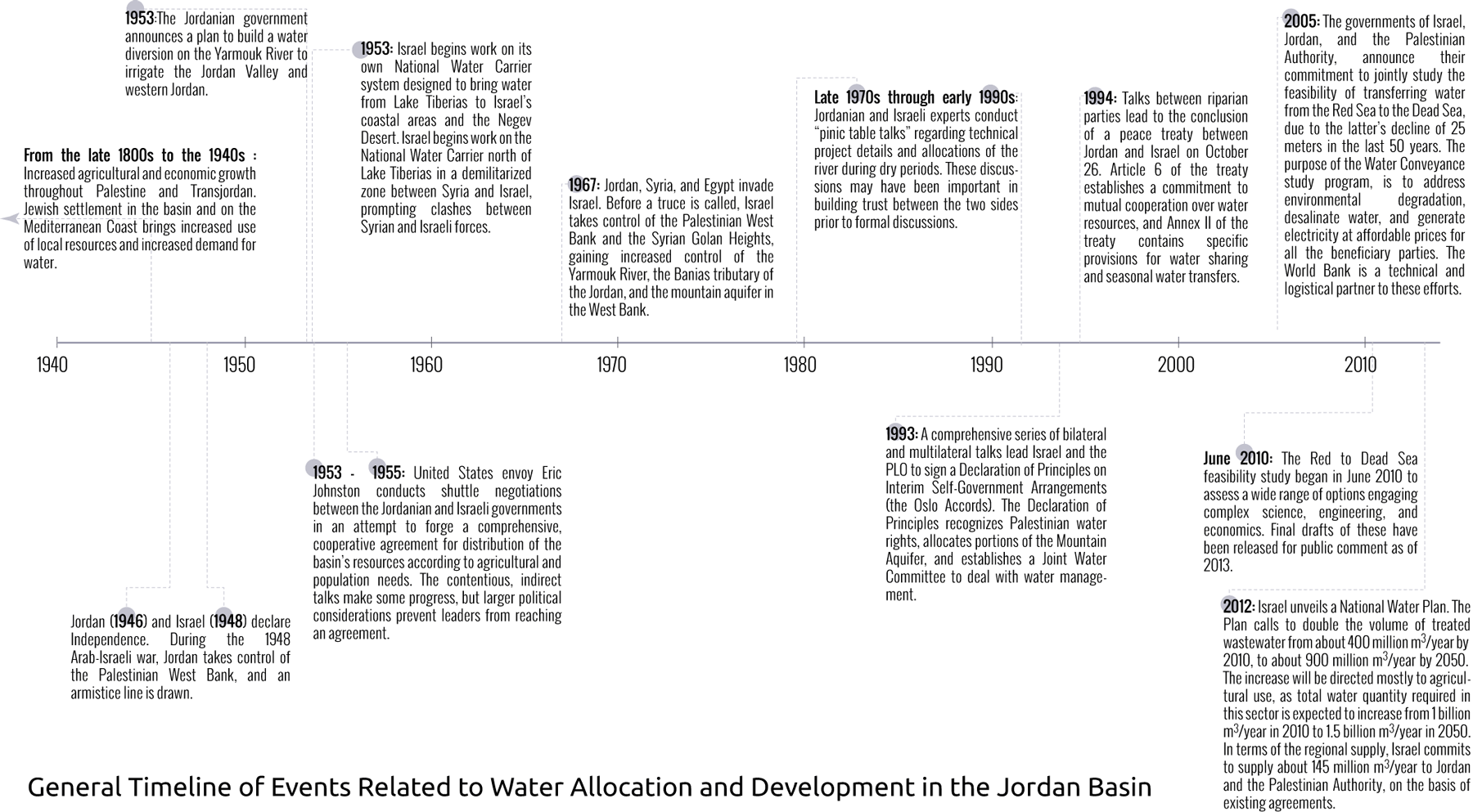
| 14:13, 12 November 2013 | GeneralTimeLineWaterSharingJordanBasin.png (file) |  |
238 KB | Amanda | better resolution | 2 |
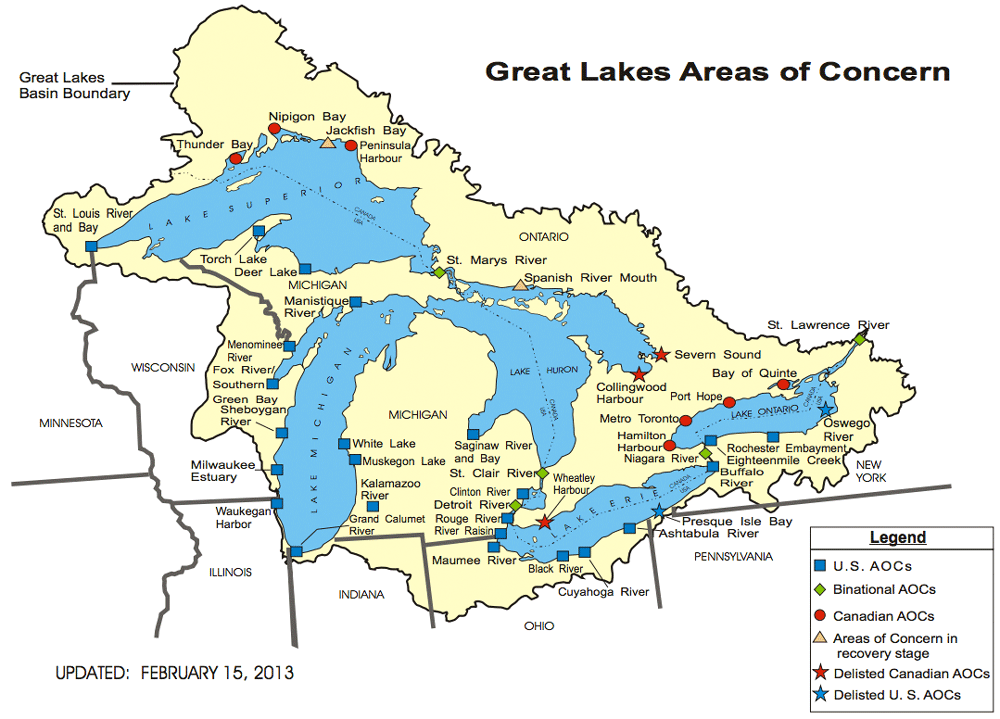
| 10:31, 16 May 2014 | GreatLakes-AOC-USEPA.png (file) |  |
151 KB | Amanda | adapted from - http://www.epa.gov/greatlakes/aoc/images/aoc-glbasin-map-20130215.pdf "The U.S.-Canada Great Lakes Water Quality Agreement (Annex 2 of the 1987 Protocol) defines AOCs as "geographic areas that fail to meet the general or specific object... | 1 |
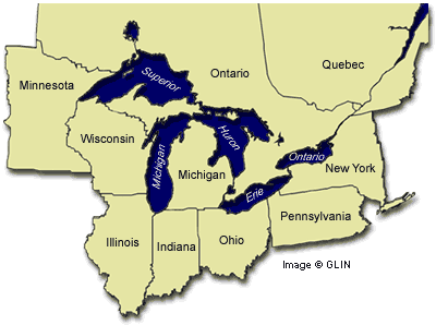
| 11:04, 16 May 2014 | Great Lakes Basin Map.gif (file) |  |
17 KB | Amanda | GLIN map of Great Lakes region with adjacent U.S. States and Candaian provinces, highlighting drainage basin http://www.great-lakes.net/lakes/ | 1 |
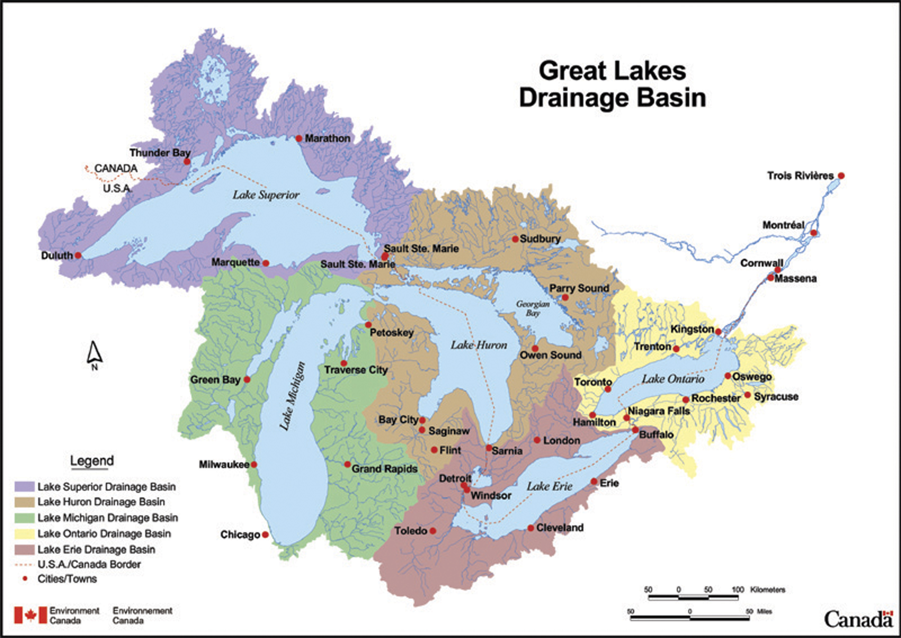
| 11:44, 16 May 2014 | Great Lakes Drainage Basin Env Canada.jpg (file) |  |
852 KB | Amanda | This map depicts the sub-basins within the Great Lakes drainage basin. This is a reproduction of a map produced by Environment Canada. It is a copy of an official work that is published by the Government of Canada and that the reproduction has not bee... | 1 |
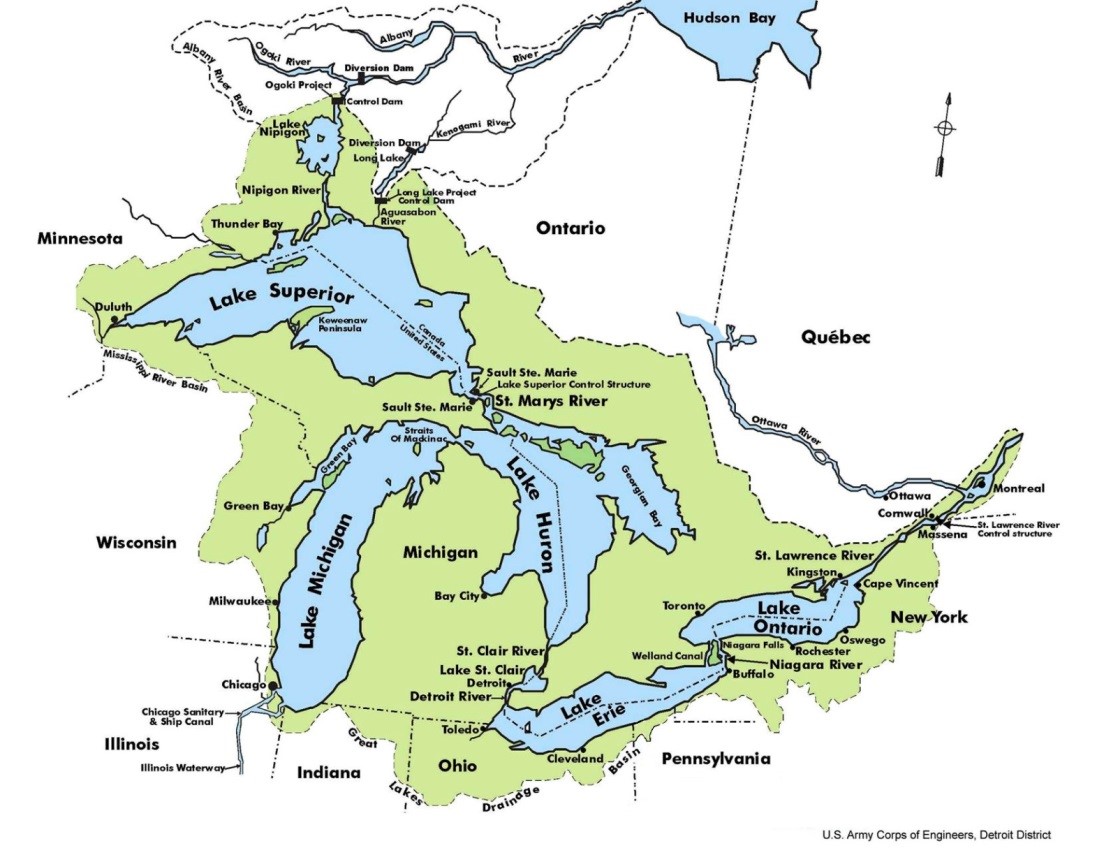
| 18:53, 21 May 2014 | Great Lakes Overview.jpeg (file) |  |
171 KB | B Finney | Taken from the US Army Corp of Engineers website: http://www.lrd-wc.usace.army.mil/LRD-WM/GreatLakes/GreatLakes.html | 1 |
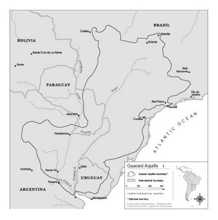
| 13:38, 20 August 2012 | Guarani Aquifer.jpg (file) |  |
20 KB | Mpritchard | Wide use of electronic and hardcopy versions of data, GIS coverages, and findings produced by the Transboundary Freshwater Dispute Database (TFDD) project is encouraged. The data, coverages, and findings are not copyrighted, although due credit is apprec | 1 |
| 11:31, 7 January 2013 | Help-asterisk-explained.png (file) |  |
483 B | Amanda | Icon used in help pages in a div explaining more about a topic, following an asterisk. | 1 |
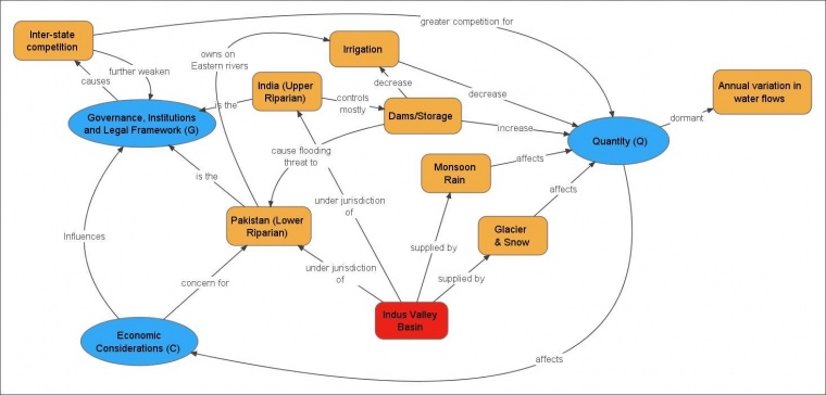
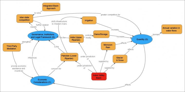
| 08:09, 30 January 2015 | Hydro-diplomacy to Address the Transboundary Water Issues between India and Pakistan.pdf (file) | 3.1 MB | Ashfaqm | PDF slide version of presentation: Mahmoud, A. 2014. Hydro-diplomacy to Address the Transboundary Water Issues between India and Pakistan Presentation from IUCN 2nd National Consultative Workshop on Pakistan Water Issues (3 June 2014) Available from:... | 1 | |
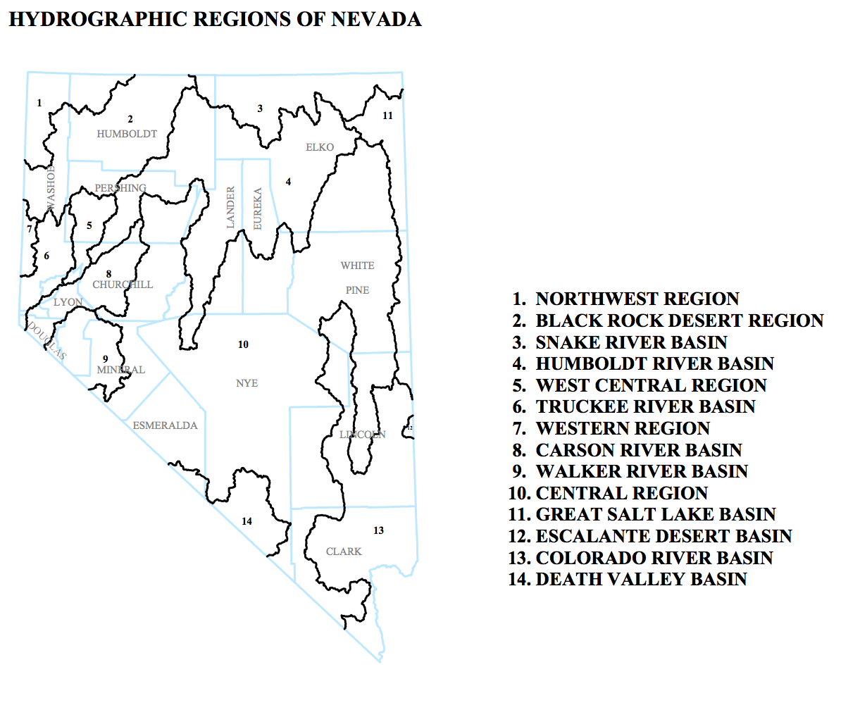
| 14:38, 16 May 2013 | Hydrographic-Regions-of-Nevada.png (file) |  |
203 KB | Amanda | This is an inset from a map entitled "DESIGNATED GROUNDWATER BASINS OF NEVADA" produced by: Department of Conservation and Natural Resources Office of the StateEngineer Division of Water Resources Carson City, Nevada 89701 In addition to the regions sh | 1 |
| 21:27, 28 April 2014 | IRD strategy-map.png (file) |  |
121 KB | TSP | 2 | |
| 22:37, 26 March 2012 | IWT framework for Baglihar Dam.jpg (file) |  |
33 KB | Administrator | 1 | |
| 09:10, 30 January 2015 | Indus-River-Linking-Project-Pakistan.png (file) |  |
67 KB | Ashfaqm | From World Bank (2005) Pakistan Country Water Resources Assistance Strategy Water Economy: Running Dry. Report No. 34081-PK. Washington, DC: World Bank. Available Online http://documents.worldbank.org/curated/en/2005/11/6492396/pakistan-country-water... | 1 |
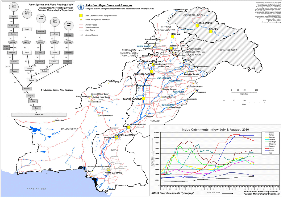
| 15:22, 31 January 2013 | Indus River Pakistan Dams WFP 2010 example.png (file) |  |
202 KB | Amanda | Very low res (screen preview) version of map available from: [http://www.wfp.org/maps/pakistan-major-dams-and-barrages-11-august-2010-high-resolution] or from [http://epmaps.wfp.org/maps/04165_20100812_PAK_A4_ODEP_Pakistan__Major_Dams_and_Barrages,_11 | 1 |
| 22:37, 26 March 2012 | Indus Waters Treaty.jpg (file) |  |
70 KB | Administrator | 1 | |
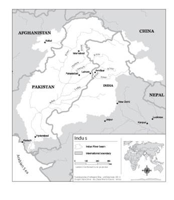
| 11:56, 31 July 2012 | Indusriverbasin.jpg (file) |  |
15 KB | Mpritchard | Map of the Indus River Basin. Wide use of electronic and hardcopy versions of data, GIS coverages, and findings produced by the Transboundary Freshwater Dispute Database (TFDD) project is encouraged. The data, coverages, and findings are not copyrighted, | 1 |
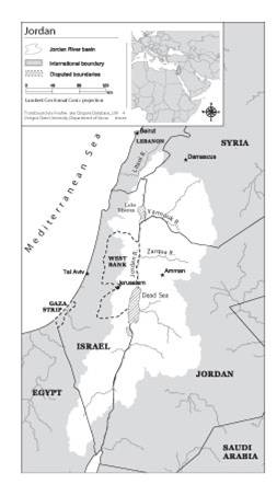
| 14:51, 31 July 2012 | Jordanriverbasin.jpg (file) |  |
15 KB | Mpritchard | Map of the Jordan River and tributaries (directly and indirectly, including Litani) Wide use of electronic and hardcopy versions of data, GIS coverages, and findings produced by the Transboundary Freshwater Dispute Database (TFDD) project is encouraged. | 1 |
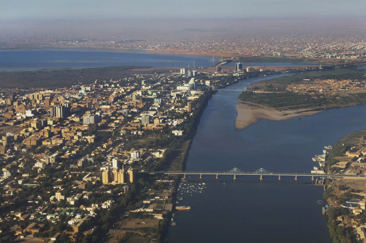
| 17:21, 21 December 2015 | Khartoum02.jpg (file) |  |
184 KB | Agustinbotteron | 1 | |
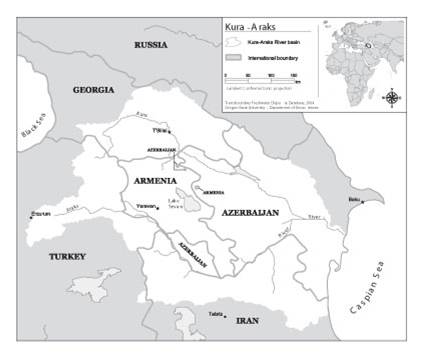
| 12:57, 1 August 2012 | Kuraaraks.jpg (file) |  |
16 KB | Mpritchard | Wide use of electronic and hardcopy versions of data, GIS coverages, and findings produced by the Transboundary Freshwater Dispute Database (TFDD) project is encouraged. The data, coverages, and findings are not copyrighted, although due credit is apprec | 1 |
First page |
 Previous page |
 Next page |
Last page |


