File:Indusriverbasin.jpg
From AquaPedia Case Study Database
No higher resolution available.
Indusriverbasin.jpg (347 × 399 pixels, file size: 15 KB, MIME type: image/jpeg)
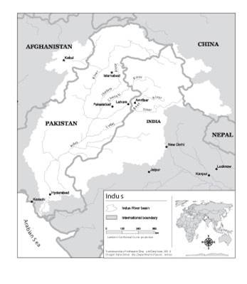
Map of the Indus River Basin. Wide use of electronic and hardcopy versions of data, GIS coverages, and findings produced by the Transboundary Freshwater Dispute Database (TFDD) project is encouraged. The data, coverages, and findings are not copyrighted, although due credit is appreciated. Please attach this credit when citing TFDD products: “Product of the Transboundary Freshwater Dispute Database, Department of Geosciences, Oregon State University. Additional information about the TFDD can be found at: <http://www.transboundarywaters.orst.edu>.”
File history
Click on a date/time to view the file as it appeared at that time.
| Date/Time | Thumbnail | Dimensions | User | Comment | |
|---|---|---|---|---|---|
| current | 11:56, 31 July 2012 | | 347 × 399 (15 KB) | Mpritchard (Talk | contribs) | Map of the Indus River Basin. Wide use of electronic and hardcopy versions of data, GIS coverages, and findings produced by the Transboundary Freshwater Dispute Database (TFDD) project is encouraged. The data, coverages, and findings are not copyrighted, |
- You cannot overwrite this file.
File usage
The following page links to this file:


