File:Cameroon-regional-overview.png
Summary
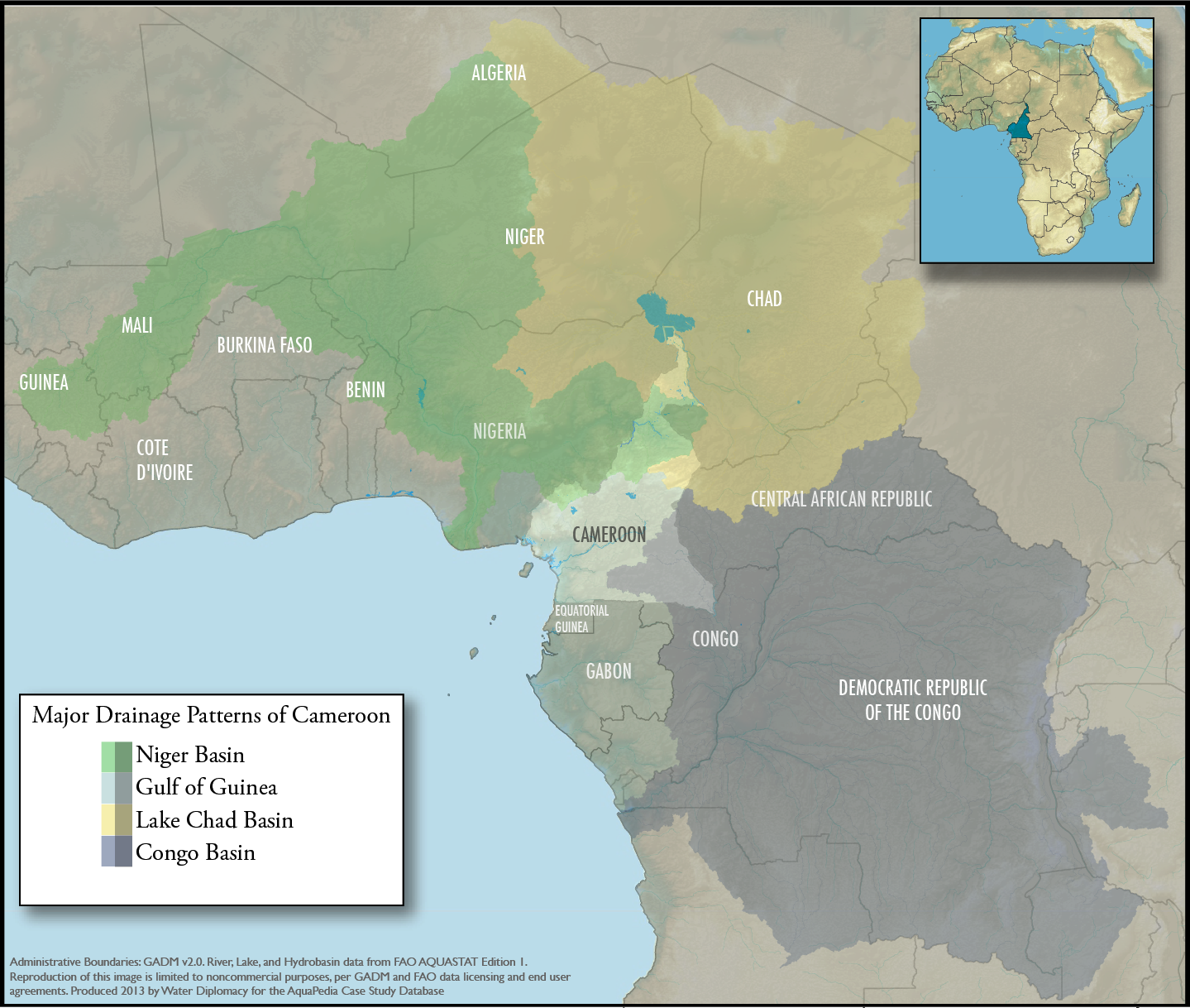
An overview map showing Cameroon within the context of the 4 major drainage patterns: Niger Basin, Lake Chad, Congo Basin, and Gulf of Guinea. Produced by Water Diplomacy for Cameroon-related articles
Data Sources: GADM v2.0 (Administrative Boundaries) and FAO AQUASTAT (Hydrologic features and drainage basin boundaries). Note that data licensing for these sources require non-commercial image use only.
Licensing: CC-BY-NC-SA
Licensing
Files listed as having license "other" do not conform to a standard public domain or creative commons standard.
This may be a file that has been included with the express permission of the creator/owner, or it may be included under the fair-use exclusion. AquaPedia will remove any files which are obviously presented in violation of their copyright, or at the request of the content owner.
Please see the file summary for more info. If you added this file, please annotate the file summary with information about the file and its terms of use and reason it was included.
File history
Click on a date/time to view the file as it appeared at that time.
| Date/Time | Thumbnail | Dimensions | User | Comment | |
|---|---|---|---|---|---|
| current | 15:48, 23 September 2013 | | 1,439 × 1,218 (1.43 MB) | Amanda (Talk | contribs) | An overview map showing Cameroon within the context of the 4 major drainage patterns: Niger Basin, Lake Chad, Congo Basin, and Gulf of Guinea. Produced by Water Diplomacy for Cameroon-related articles Data Sources: GADM v2.0 (Administrative Boundarie... |
- You cannot overwrite this file.
File usage
The following 2 pages link to this file:


