File:ACF-overview.png
From AquaPedia Case Study Database

Size of this preview: 746 × 599 pixels. Other resolutions: 747 × 600 pixels | 1,475 × 1,185 pixels.
Original file (1,475 × 1,185 pixels, file size: 431 KB, MIME type: image/png)
Summary
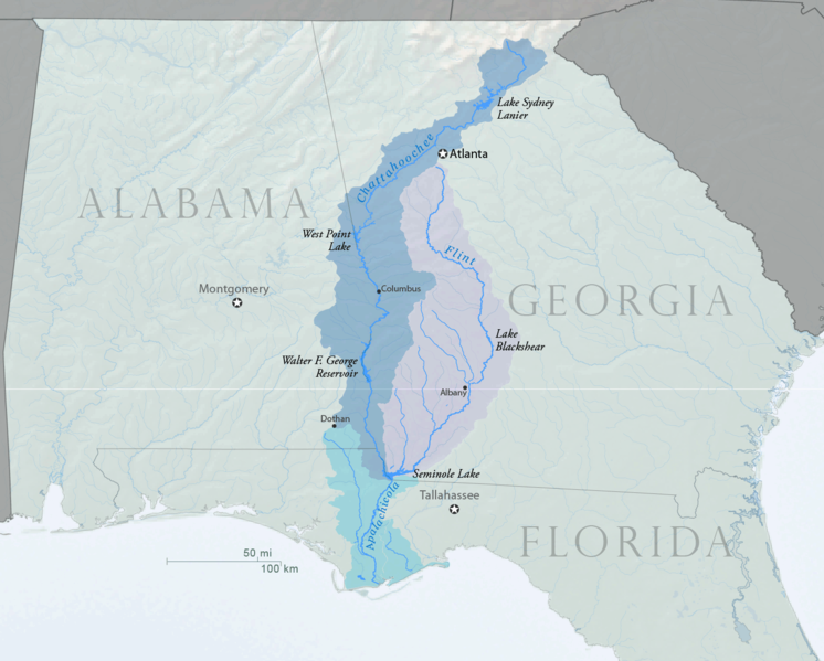
Map overview showing ACF (Apalachicola-Chattahoochee-Flint) Basin and major reservoirs within the basin. Created by Water Diplomacy using USGS and U.S. Census Bureau Data sources in October 2013.
Licensing
Creative Commons Attribution-Share Alike
View a CC-by-SA on the Creative Commons website for more information about this type of content licensing.
Additionally, there is easy to read information about this topic at Wikipedia (Article: Creative Commons license).
See file description for additional details on the type and scope of agreement for the specific file referenced.
File history
Click on a date/time to view the file as it appeared at that time.
| Date/Time | Thumbnail | Dimensions | User | Comment | |
|---|---|---|---|---|---|
| current | 11:39, 10 October 2013 |  | 1,475 × 1,185 (431 KB) | Amanda (Talk | contribs) | Map overview showing ACF (Apalachicola-Chattahoochee-Flint) Basin and major reservoirs within the basin. Created by Water Diplomacy using USGS and U.S. Census Bureau Data sources in October 2013. |
- You cannot overwrite this file.
File usage
There are no pages that link to this file.


