File list
This special page shows all uploaded files.
| Name | Thumbnail | Size | User | Description | Versions | |
|---|---|---|---|---|---|---|
| 16:01, 27 August 2012 | ALTorgchart.jpg (file) |  |
18 KB | Mpritchard | Wide use of electronic and hardcopy versions of data, GIS coverages, and findings produced by the Transboundary Freshwater Dispute Database (TFDD) project is encouraged. The data, coverages, and findings are not copyrighted, although due credit is apprec | 1 |
| 15:41, 27 August 2012 | Laketiticacatfddimage.jpg (file) | 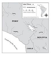 |
11 KB | Mpritchard | Wide use of electronic and hardcopy versions of data, GIS coverages, and findings produced by the Transboundary Freshwater Dispute Database (TFDD) project is encouraged. The data, coverages, and findings are not copyrighted, although due credit is apprec | 1 |
| 10:05, 23 August 2012 | Umatillanewmap.jpg (file) | 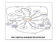 |
75 KB | Mpritchard | Created and provided by Dr. Todd Jarvis, Director of the Institute for Water and Watersheds, Oregon State University. The image is not copyrighted, though due credit is appreciated. Please attach the above credit when used. | 1 |
| 14:26, 21 August 2012 | Aral Sea.jpg (file) | 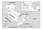 |
28 KB | Mpritchard | Wide use of electronic and hardcopy versions of data, GIS coverages, and findings produced by the Transboundary Freshwater Dispute Database (TFDD) project is encouraged. The data, coverages, and findings are not copyrighted, although due credit is apprec | 1 |
| 09:43, 21 August 2012 | US Mexico Aquifers.jpg (file) | 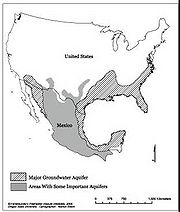 |
15 KB | Mpritchard | Wide use of electronic and hardcopy versions of data, GIS coverages, and findings produced by the Transboundary Freshwater Dispute Database (TFDD) project is encouraged. The data, coverages, and findings are not copyrighted, although due credit is apprec | 1 |
| 12:38, 20 August 2012 | Guarani Aquifer.jpg (file) | 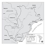 |
20 KB | Mpritchard | Wide use of electronic and hardcopy versions of data, GIS coverages, and findings produced by the Transboundary Freshwater Dispute Database (TFDD) project is encouraged. The data, coverages, and findings are not copyrighted, although due credit is apprec | 1 |
| 11:26, 16 August 2012 | Senegalriver.jpg (file) | 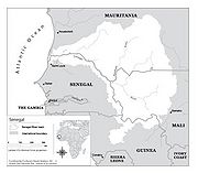 |
19 KB | Mpritchard | Wide use of electronic and hardcopy versions of data, GIS coverages, and findings produced by the Transboundary Freshwater Dispute Database (TFDD) project is encouraged. The data, coverages, and findings are not copyrighted, although due credit is apprec | 1 |
| 13:27, 15 August 2012 | Middleeastwater.jpg (file) | 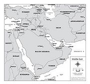 |
20 KB | Mpritchard | Wide use of electronic and hardcopy versions of data, GIS coverages, and findings produced by the Transboundary Freshwater Dispute Database (TFDD) project is encouraged. The data, coverages, and findings are not copyrighted, although due credit is apprec | 1 |
| 10:42, 14 August 2012 | Tigriseuphrates.jpg (file) | 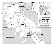 |
30 KB | Mpritchard | Wide use of electronic and hardcopy versions of data, GIS coverages, and findings produced by the Transboundary Freshwater Dispute Database (TFDD) project is encouraged. The data, coverages, and findings are not copyrighted, although due credit is apprec | 1 |
| 10:47, 6 August 2012 | Salweenriverbasin.jpg (file) | 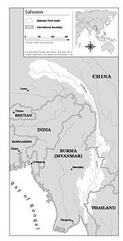 |
14 KB | Mpritchard | Wide use of electronic and hardcopy versions of data, GIS coverages, and findings produced by the Transboundary Freshwater Dispute Database (TFDD) project is encouraged. The data, coverages, and findings are not copyrighted, although due credit is apprec | 1 |
| 12:33, 2 August 2012 | Mekongcommitteeorgchart.jpg (file) | 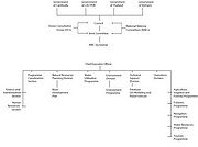 |
18 KB | Mpritchard | Wide use of electronic and hardcopy versions of data, GIS coverages, and findings produced by the Transboundary Freshwater Dispute Database (TFDD) project is encouraged. The data, coverages, and findings are not copyrighted, although due credit is apprec | 1 |
| 12:11, 2 August 2012 | Mekongriverbasin.jpg (file) | 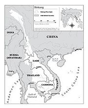 |
17 KB | Mpritchard | Map of the Mekong River Basin. Wide use of electronic and hardcopy versions of data, GIS coverages, and findings produced by the Transboundary Freshwater Dispute Database (TFDD) project is encouraged. The data, coverages, and findings are not copyrighted | 1 |
| 13:16, 1 August 2012 | Laplata.jpg (file) | 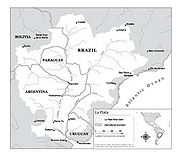 |
18 KB | Mpritchard | Wide use of electronic and hardcopy versions of data, GIS coverages, and findings produced by the Transboundary Freshwater Dispute Database (TFDD) project is encouraged. The data, coverages, and findings are not copyrighted, although due credit is apprec | 1 |
| 11:57, 1 August 2012 | Kuraaraks.jpg (file) | 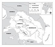 |
16 KB | Mpritchard | Wide use of electronic and hardcopy versions of data, GIS coverages, and findings produced by the Transboundary Freshwater Dispute Database (TFDD) project is encouraged. The data, coverages, and findings are not copyrighted, although due credit is apprec | 1 |
| 13:51, 31 July 2012 | Jordanriverbasin.jpg (file) | 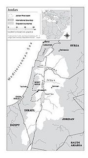 |
15 KB | Mpritchard | Map of the Jordan River and tributaries (directly and indirectly, including Litani) Wide use of electronic and hardcopy versions of data, GIS coverages, and findings produced by the Transboundary Freshwater Dispute Database (TFDD) project is encouraged. | 1 |
| 10:56, 31 July 2012 | Indusriverbasin.jpg (file) | 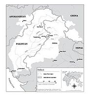 |
15 KB | Mpritchard | Map of the Indus River Basin. Wide use of electronic and hardcopy versions of data, GIS coverages, and findings produced by the Transboundary Freshwater Dispute Database (TFDD) project is encouraged. The data, coverages, and findings are not copyrighted, | 1 |
| 11:13, 30 July 2012 | GangesBasin.jpg (file) | 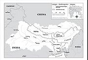 |
21 KB | Mpritchard | Map of the Ganges- Brahmaputra-Megna basin (TFDD, 2012).“Product of the Transboundary Freshwater Dispute Database, Department of Geosciences, Oregon State University. Additional information about the TFDD can be found at: <http://www.transboundarywater | 1 |
| 13:20, 27 July 2012 | DanudeRiverBasin.jpg (file) | 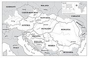 |
28 KB | Mpritchard | Map of the Danube River Basin “Product of the Transboundary Freshwater Dispute Database, Department of Geosciences, Oregon State University. Additional information about the TFDD can be found at: <http://www.transboundarywaters.orst.edu>.” | 1 |
| 11:05, 27 July 2012 | 2007Umatillasubbasinsituationmap.jpg (file) | 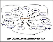 |
46 KB | Mpritchard | Preliminary depiction of stakeholders and linkages for the groundwater situation in the Umatilla Basin, Northwestern US. “OASIS” was a proposed project to divert water from the Columbia River. DLCD denotes the Oregon Department of Land and Conservatio | 1 |
| 10:56, 27 July 2012 | BlockdiagramofUmatillaBasinhydrogeology.jpg (file) | 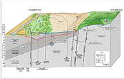 |
171 KB | Mpritchard | “Product of the Transboundary Freshwater Dispute Database, Department of Geosciences, Oregon State University. Additional information about the TFDD can be found at: <http://www.transboundarywaters.orst.edu>.” | 1 |
| 14:05, 16 July 2012 | Warning triangle.png (file) |  |
3 KB | Amanda | Created for AquaPedia. Released to Public Domain. CC-0. | 1 |
| 14:01, 16 July 2012 | External link icon.png (file) | 8 KB | Amanda | background removed | 2 | |
| 13:13, 16 July 2012 | Wikify icon.png (file) | 3 KB | Amanda | created for AquaPedia. available for use under CC-0 License. http://creativecommons.org/about/cc0 | 1 | |
| 12:56, 16 July 2012 | Question book edit.png (file) |  |
5 KB | Amanda | This file was edited from a file available from http://en.wikipedia.org/wiki/File:Question_book-new.svg (which was created by Wikipedia user Tkgd2007, and based on a similar image created by a different user). Image is available for use by anyone under a | 1 |
| 14:00, 2 July 2012 | Broom-icon.png (file) | 2 KB | Amanda | Broom Icon created specifically for AquaPedia. Released under CC-BY-SA 3.0 | 1 | |
| 13:48, 13 June 2012 | Add icon.png (file) | 14 KB | Amanda | 1 | ||
| 12:23, 13 June 2012 | Murillo rafferty ilisu network.png (file) | 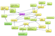 |
503 KB | Amanda | Network respresentation of issues/stakeholders for analysis of the Ilisu Dam Project in Turkey by Maria E. Martinez Murillo C. and Mark Rafferty Originally prepared in conjunction with WD III Seminar (Tufts University) course requirements. | 1 |
| 10:53, 13 June 2012 | Nicoll tigris fig3.jpg (file) | 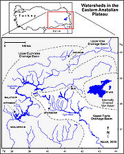 |
368 KB | Amanda | screen resolution | 1 |
| 08:59, 6 June 2012 | Wra wsa wang delangelis 2012.jpg (file) | 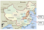 |
317 KB | Amanda | Figure 6 Water Source and Receiving Area of MRP (Map is from [http://www.sacu.org]) annotations added by Wang and DeAngelis to source map available online at sacu.org Base map used in good faith under assumptions of fair use exemption. | 1 |
| 08:39, 6 June 2012 | MRP case provinces.jpg (file) |  |
360 KB | Amanda | 18 Water Quality Control Zone in Danjiangkou Reservoir Watershed in three provinces Water Pollution Control & Soild and Water Conservation Plan Drafting Committee Water Pollution Control & Soil and Water Conservation Plan of Danjiangkou Reservoir and Up | 1 |
| 08:27, 6 June 2012 | Satellite of MRP region.jpg (file) |  |
285 KB | Amanda | Public Domain Satellite Image Screenshot. Labelled by Rose Wang and Kelly DeAngelis, 2012 | 1 |
| 08:10, 6 June 2012 | MRP zones image.jpg (file) |  |
271 KB | Amanda | Adapted from Water Pollution Control & Soild and Water Conservation Plan Drafting Committee Water Pollution Control & Soil and Water Conservation Plan of Danjiangkou Reservoir and Upstream. (2005). Base image used without permission under good faith use | 1 |
| 07:24, 6 June 2012 | Structure of china govt wang deangelis 2012.jpg (file) | 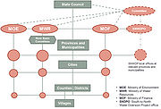 |
307 KB | Amanda | Political Structure of Chinese Government Developed for Middle Route Project Case Study Rose Wang and Kelly DeAngelis 2012. | 1 |
| 07:21, 6 June 2012 | River project watershed Zhang2009.jpg (file) | 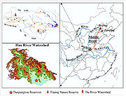 |
456 KB | Amanda | Image from: Zhang, Q., Xu, Z., Shen, Z., Li, S. & Wang, S. The Han River watershed management initiative for the South-to-North water transfer project (Middle Route) of China. ''Environmental monitoring and assessment'' 148, 369–377 (2009). Used to des | 1 |
| 07:14, 6 June 2012 | Deangelis and Wang Network MRP 2012.jpg (file) | 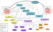 |
460 KB | Amanda | A Network Representation Diagram for Water Quality Control on South-to-North Water Diversion (SNWD) Middle Route Project (MRP) Case Study (2012). Yuan Wang and Kelly DeAngelis. Created May 2012. Prepared for Water Diplomacy Seminar III at Tufts Universi | 1 |
| 13:00, 7 May 2012 | Add.png (file) |  |
4 KB | Administrator | 1 | |
| 13:33, 27 April 2012 | Gears notice 100.png (file) |  |
3 KB | Amanda | thumbnail image to use in conjunction with mboxes | 1 |
| 09:14, 21 April 2012 | Test network.png (file) | 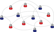 |
52 KB | Administrator | Gamma's network | 1 |
| 21:38, 26 March 2012 | Variables.jpg (file) |  |
62 KB | Administrator | 1 | |
| 21:37, 26 March 2012 | NSS framework for IWT.jpg (file) | 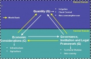 |
33 KB | Administrator | 1 | |
| 21:37, 26 March 2012 | Location of Indus River.jpg (file) | 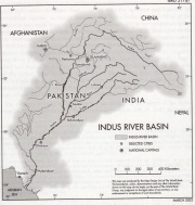 |
152 KB | Administrator | 1 | |
| 21:37, 26 March 2012 | IWT framework for Baglihar Dam.jpg (file) | 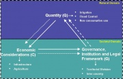 |
33 KB | Administrator | 1 | |
| 21:37, 26 March 2012 | Indus Waters Treaty.jpg (file) |  |
70 KB | Administrator | 1 | |
| 21:36, 26 March 2012 | During Partition.jpg (file) |  |
68 KB | Administrator | 1 | |
| 21:36, 26 March 2012 | Chronology.jpg (file) | 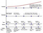 |
43 KB | Administrator | 1 | |
| 21:36, 26 March 2012 | British Administration.jpg (file) |  |
65 KB | Administrator | 1 | |
| 18:43, 23 March 2012 | Dominant Variables.jpg (file) |  |
22 KB | Administrator | Dominant Variable for Volta River Basin Case Study | 1 |
| 18:42, 23 March 2012 | Timeline.jpg (file) | 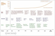 |
88 KB | Administrator | Timeline of Volta River Basin | 1 |
| 18:42, 23 March 2012 | Climatic Data.jpg (file) | 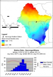 |
47 KB | Administrator | Climatic Data for Volta River Basin | 1 |
| 18:41, 23 March 2012 | Volta River Basin.jpg (file) | 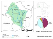 |
161 KB | Administrator | 1 |
 First page |
 Previous page |
 Next page |
 Last page |


