File list
This special page shows all uploaded files.
| Name | Thumbnail | Size | User | Description | Versions | |
|---|---|---|---|---|---|---|
| 12:28, 13 November 2017 | CASalinas.png (file) | 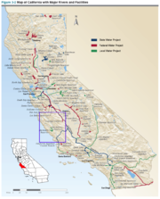 |
1.22 MB | SamKumasaka | Map of water projects in California from the California Water Project with Salinas County highlighted. | 1 |
| 12:23, 13 November 2017 | CASonoma.png (file) | 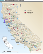 |
1.23 MB | SamKumasaka | Map of California Water Projects and Sonoma County | 1 |
| 09:18, 1 November 2017 | SonomaBasins.png (file) | 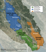 |
1.2 MB | SamKumasaka | The three groundwater basins in Sonoma County designated medium-priority: Santa Rosa Plain, Petaluma Valley, and Sonoma Valley Basins Source: CASGEM | 1 |
| 09:13, 1 November 2017 | Sal7.png (file) | 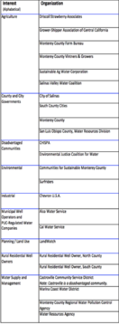 |
407 KB | SamKumasaka | Salinas Valley Groundwater Advisory Committee Represented Organizations | 1 |
| 09:10, 1 November 2017 | Sal6.png (file) |  |
207 KB | SamKumasaka | DIAGRAM: Groundwater Stakeholder Forum, Collaborative Work Group, and Committee Meetings | 1 |
| 09:07, 1 November 2017 | Sal5.png (file) | 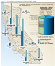 |
1.06 MB | SamKumasaka | The Importance of Groundwater to California Water Supply Groundwater comprises 38% of all water used in California, totaling more than 16 million acre-feet. Source: CA DWR | 1 |
| 09:04, 1 November 2017 | Sal4.png (file) | 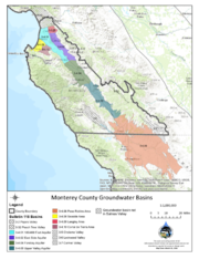 |
697 KB | SamKumasaka | Monterey County Groundwater Sub-basins | 1 |
| 08:59, 1 November 2017 | Sal3.png (file) | 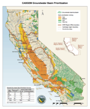 |
626 KB | SamKumasaka | CASGEM Groundwater Basin Prioritization | 1 |
 First page |
 Previous page |
 Next page |
 Last page |


