File:Gaza Strip 2011-01-20.gif
From AquaPedia Case Study Database
No higher resolution available.
Gaza_Strip_2011-01-20.gif (330 × 354 pixels, file size: 13 KB, MIME type: image/gif)
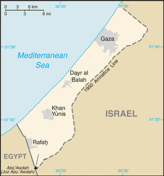
| Description | Modified version of previous file, copied from the CIA World Factbook from this page: *https://www.cia.gov/library/publications/the-world-factbook/geos/gz.html |
| Date | (UTC) |
| Source | |
| Author |
|
| This is a retouched picture, which means that it has been digitally altered from its original version. Modifications: redacted info re current political situation and airport. The original can be viewed here: Gz-map.gif:
|
This image is in the public domain because it contains materials that originally came from the United States Central Intelligence Agency's World Factbook.
|
 |
Original upload log
This image is a derivative work of the following images:
- File:Gz-map.gif licensed with PD-USGov-CIA-WF
- 2008-01-27T14:18:26Z Timeshifter 330x354 (14198 Bytes) Taken from CIA.gov map page for Gaza Strip: "This page was last updated on 24 January, 2008"
- 2008-01-27T01:58:08Z Koavf 330x354 (13178 Bytes) Removed inaccurate notice about Israeli occupation.
- 2007-12-02T14:08:51Z Timeshifter 330x354 (14198 Bytes) Nov. 15 2007 update of CIA.gov map page for Gaza Strip.
- 2005-08-15T18:09:37Z Mrmiscellanious 328x352 (9461 Bytes) Updated version of previous file, copied from CIA World Factbook on August 15, 2005.
Uploaded with derivativeFX
File history
Click on a date/time to view the file as it appeared at that time.
| Date/Time | Thumbnail | Dimensions | User | Comment | |
|---|---|---|---|---|---|
| current | 20:51, 19 January 2011 | | 330 × 354 (13 KB) | Sjsilverman | {{Information |Description=Modified version of previous file, copied from the CIA World Factbook from this page: *https://www.cia.gov/library/publications/the-world-factbook/geos/gz.html |Source=*File:Gz-map.gif |Date=2011-0 |
File usage
The following page links to this file:


