File list
This special page shows all uploaded files.
| Date | Name | Thumbnail | User | Description | Versions | |
|---|---|---|---|---|---|---|
| 22:46, 10 May 2014 | 7.jpg (file) |  |
419 KB | TSP | 2011 Thailand Flood Satellite Photo Source: http://en.wikipedia.org/wiki/2011_Thailand_floods | 1 |
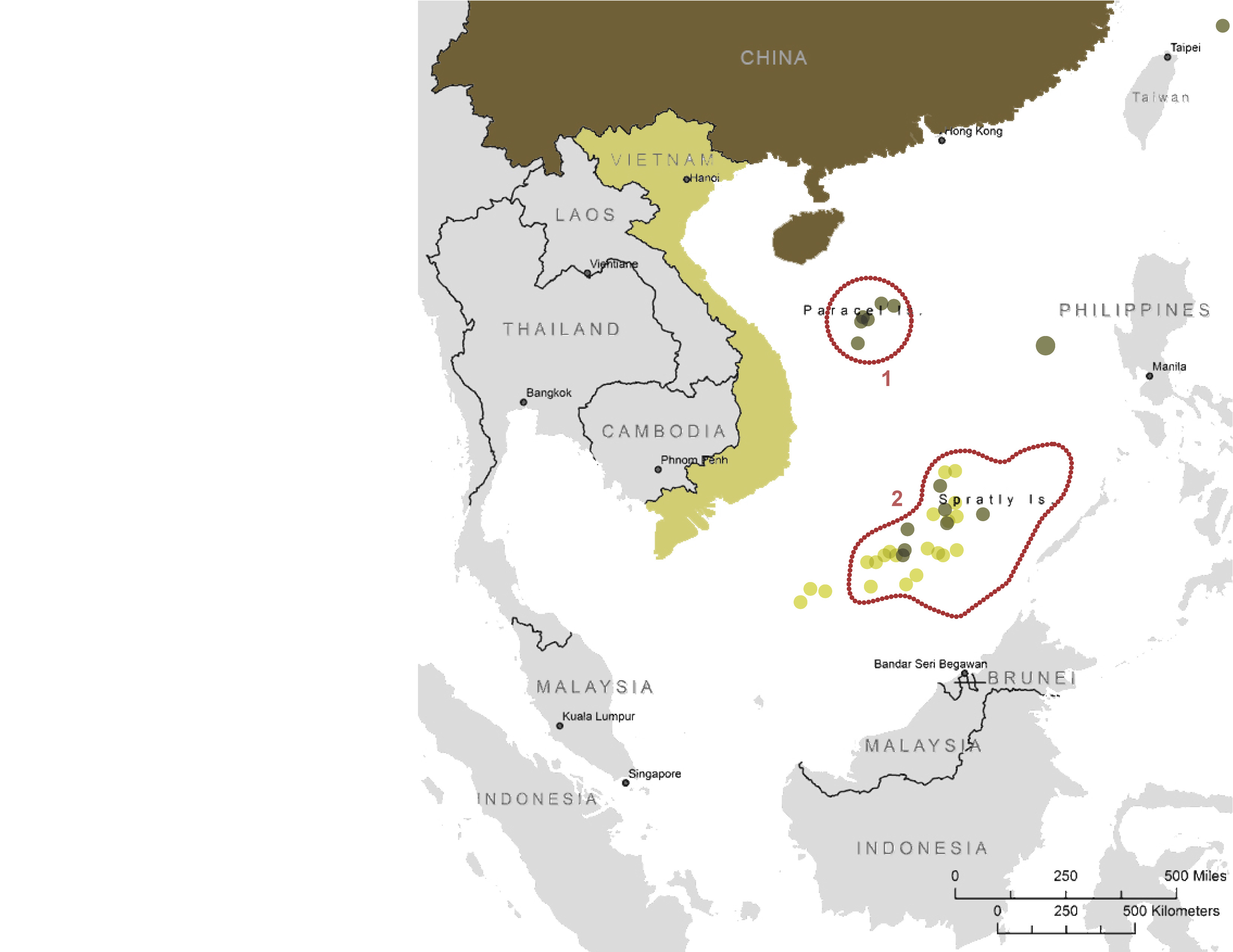
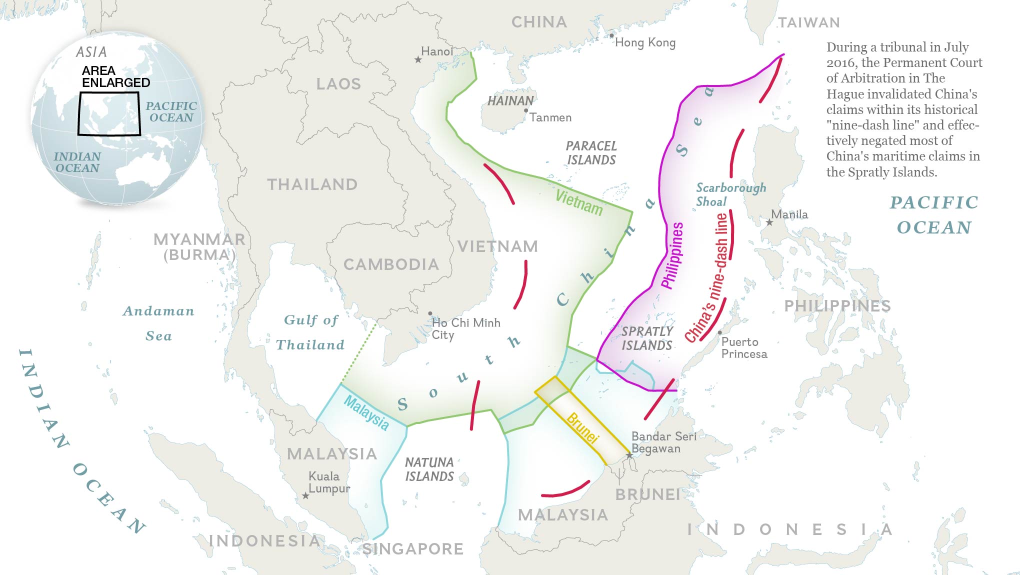
| 10:41, 25 May 2017 | -MAP-08 SouthChinaSea ChinavsVietnam-.jpg (file) |  |
419 KB | Pjular | 1 | |
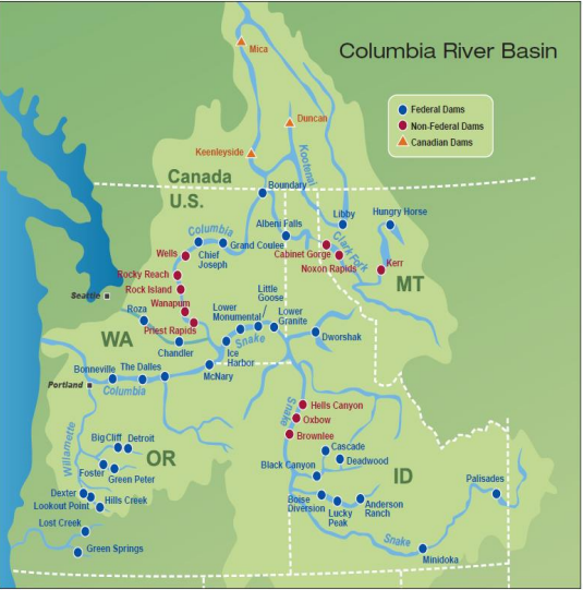
| 13:39, 18 May 2017 | Columbia River Basin.png (file) |  |
412 KB | Yanisa | Source: Bonneville Power Administration | 1 |
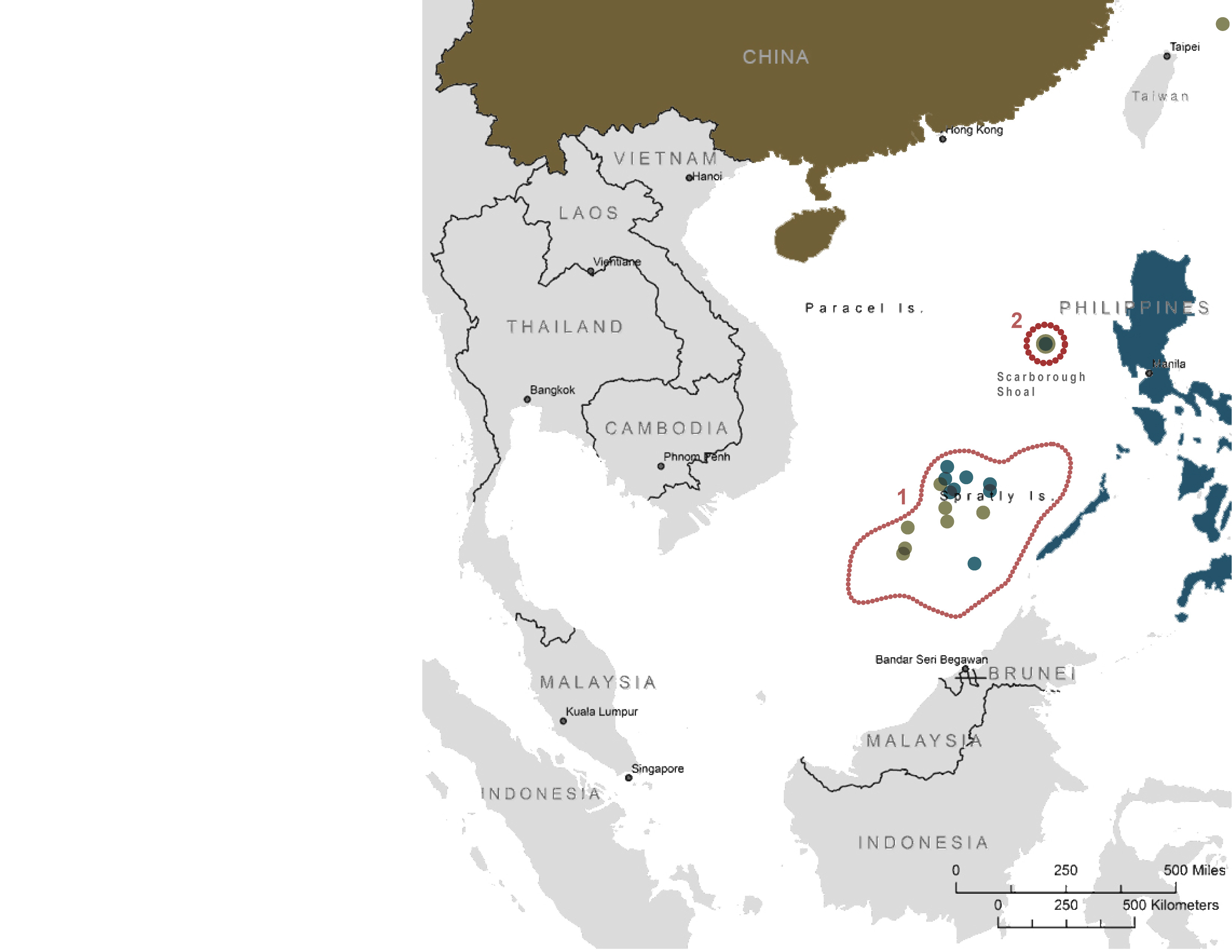
| 10:40, 25 May 2017 | -MAP-07 SouthChinaSea ChinavsPhilippines-.jpg (file) |  |
411 KB | Pjular | 1 | |
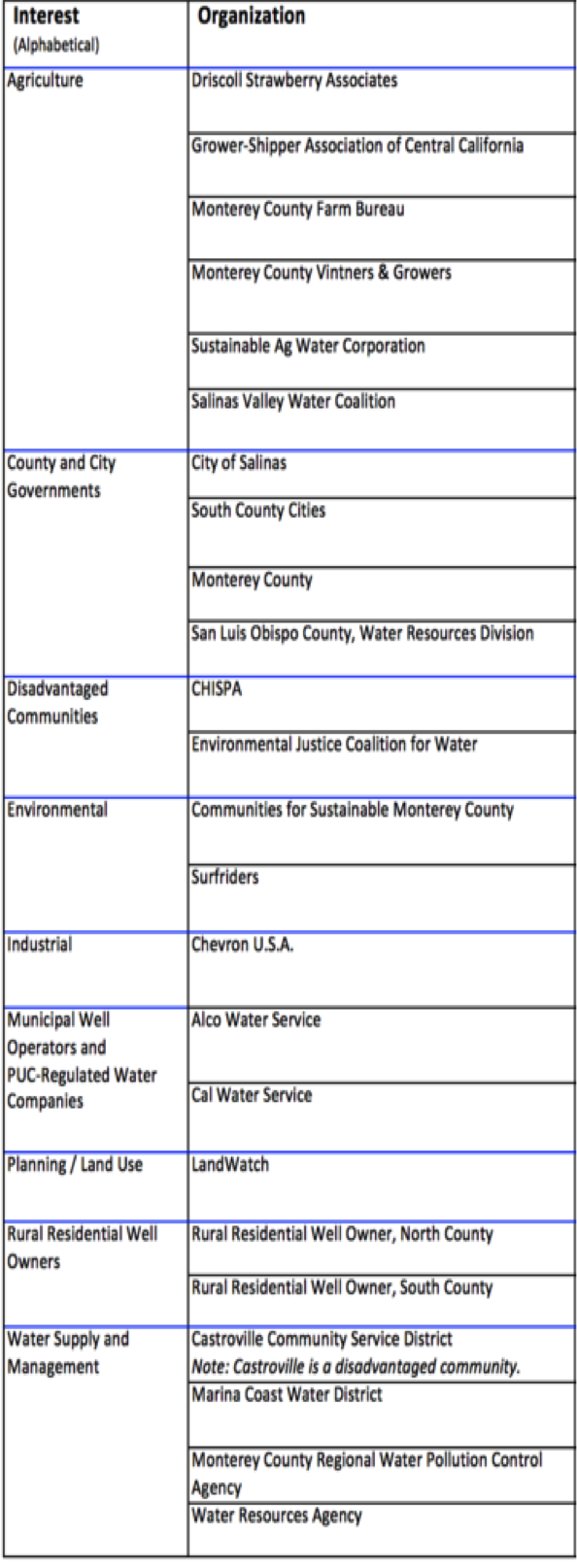
| 10:13, 1 November 2017 | Sal7.png (file) |  |
407 KB | SamKumasaka | Salinas Valley Groundwater Advisory Committee Represented Organizations | 1 |
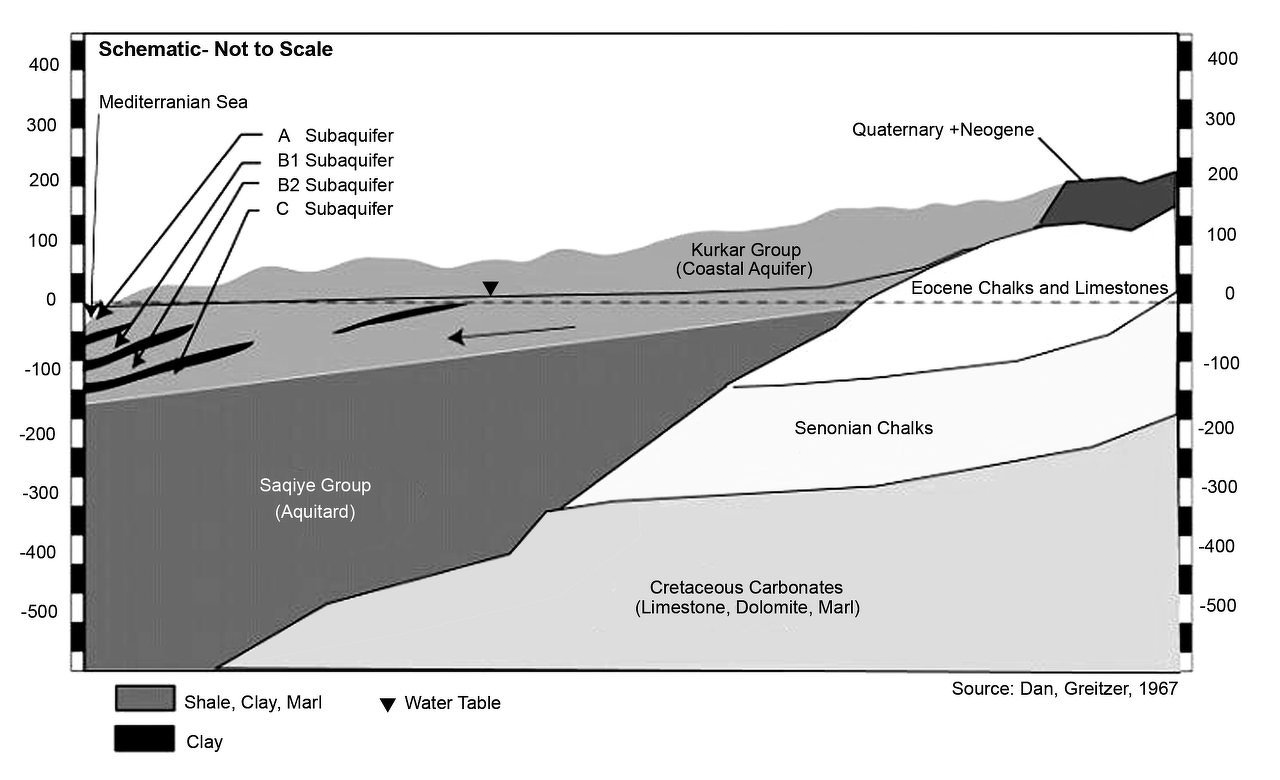
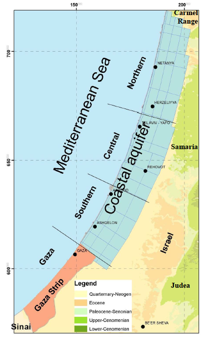
| 10:06, 26 June 2014 | Coastal-Aquifer-Schematic.png (file) |  |
393 KB | Amanda | Geologic Schematic of the Coastal Aquifer from: Greitzer, D. J. Dan. 1967, The effect of soil landscape and quaternary geology on the distribution of saline and freshwater aquifers in the Coastal Plain of Israel, Water Planning for Israel, Tel Aviv, L... | 1 |
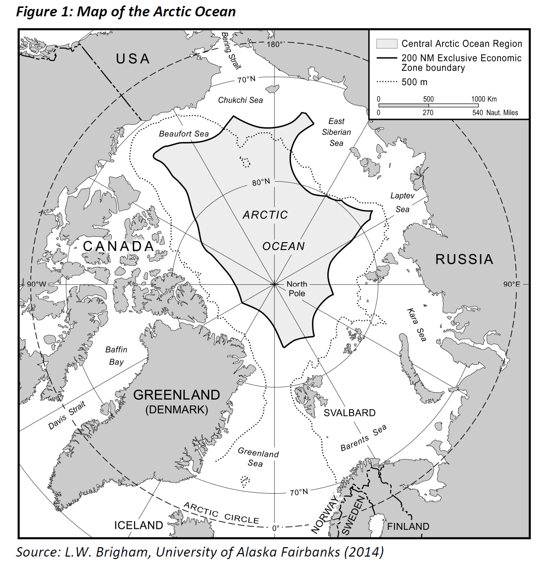
| 09:53, 18 May 2017 | CAO.png (file) |  |
392 KB | Akaush02 | Map of the Arctic Ocean | 1 |
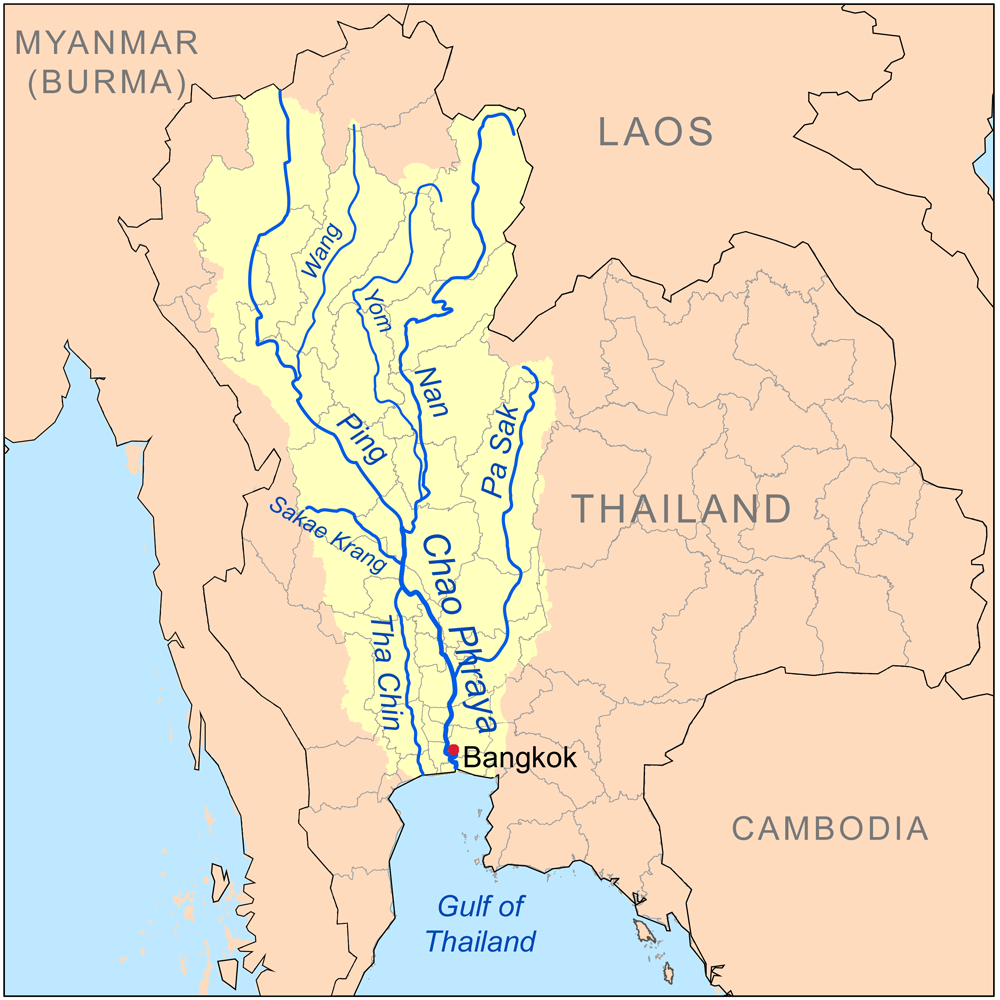
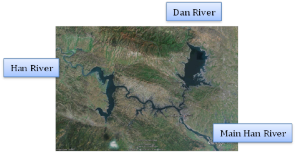
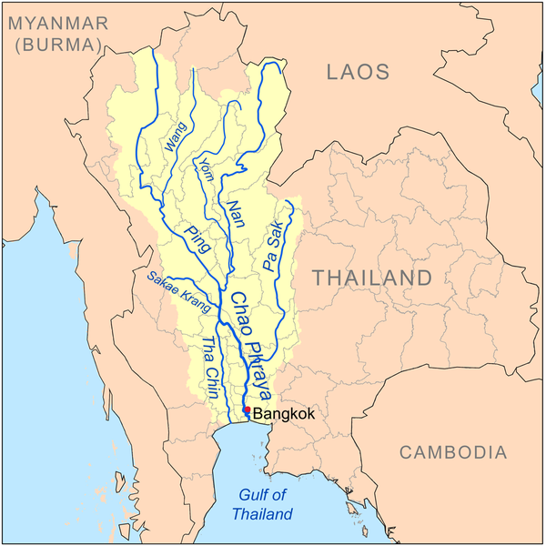
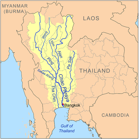
| 21:01, 30 April 2014 | Chaophrayarivermap.png (file) |  |
391 KB | TSP | The Chao Phraya River and its Tributaries Source: http://en.wikipedia.org/wiki/Tributaries_of_the_Chao_Phraya_River | 1 |
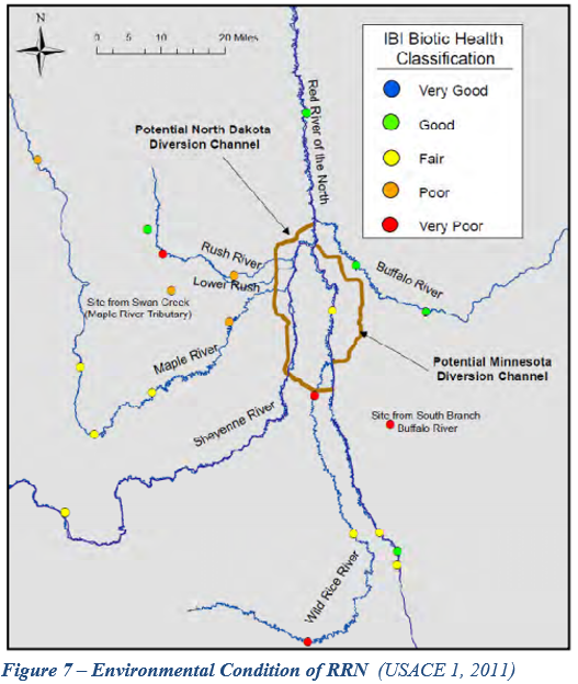
| 20:01, 6 June 2017 | Figure 7.PNG (file) |  |
376 KB | Gtbrien | 3 | |
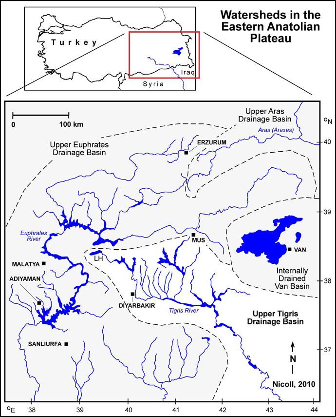
| 11:53, 13 June 2012 | Nicoll tigris fig3.jpg (file) |  |
368 KB | Amanda | screen resolution | 1 |
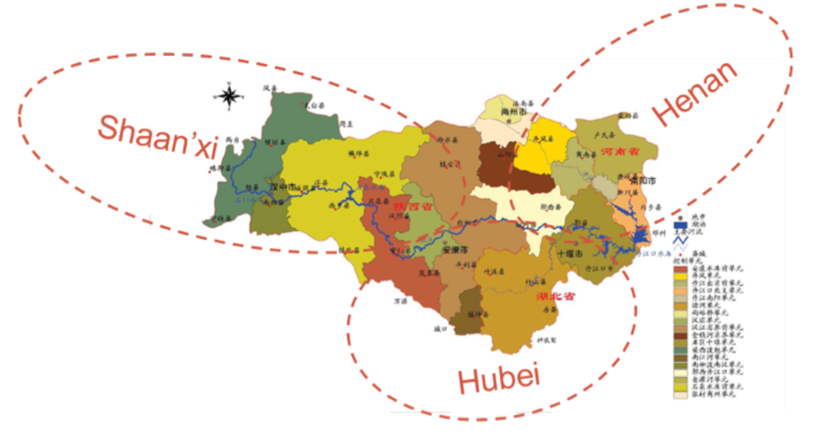
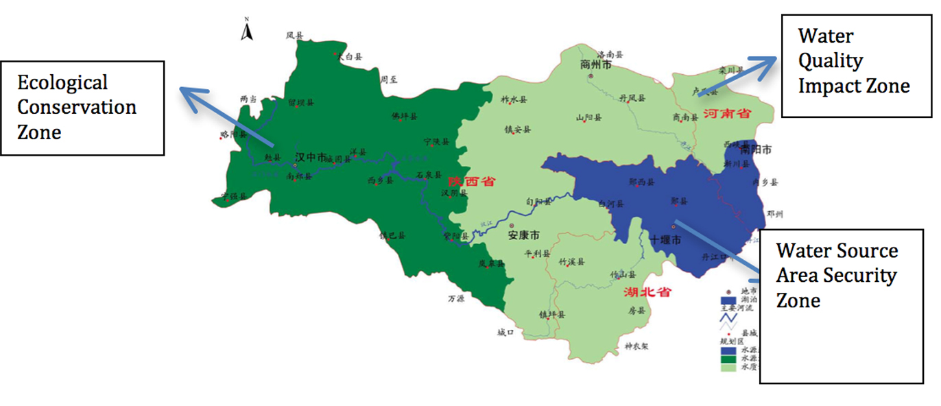
| 09:39, 6 June 2012 | MRP case provinces.jpg (file) |  |
360 KB | Amanda | 18 Water Quality Control Zone in Danjiangkou Reservoir Watershed in three provinces Water Pollution Control & Soild and Water Conservation Plan Drafting Committee Water Pollution Control & Soil and Water Conservation Plan of Danjiangkou Reservoir and Up | 1 |
| 10:37, 25 May 2017 | -MAP-04 SouthChinaSea Islands in dispute-.jpg (file) |  |
353 KB | Pjular | 1 | |
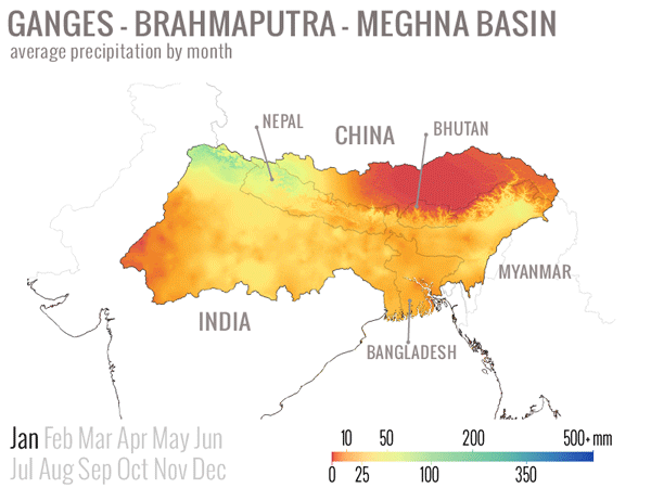
| 08:29, 18 March 2014 | GBM monthly average precip.gif (file) |  |
335 KB | Amanda | animated .GIF illustrating average monthly precipitation values in the Ganges-Brahmaputra-Meghna Basin (India, Nepal, China (Tibet), Bhutan, Bangladesh, Myanmar) Precipiation values from 30 arc-second World Clim global data set. Interpolated average p... | 1 |
| 10:41, 25 May 2017 | -Chart-01-SouthChinaSea Figures-.png (file) |  |
328 KB | Pjular | 1 | |
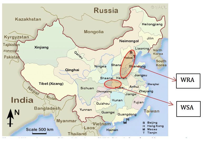
| 09:59, 6 June 2012 | Wra wsa wang delangelis 2012.jpg (file) |  |
317 KB | Amanda | Figure 6 Water Source and Receiving Area of MRP (Map is from [http://www.sacu.org]) annotations added by Wang and DeAngelis to source map available online at sacu.org Base map used in good faith under assumptions of fair use exemption. | 1 |
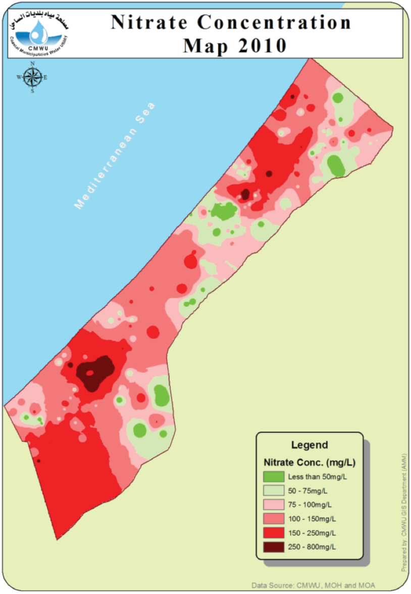
| 13:01, 26 June 2014 | CMWU-2010-nitrate.png (file) |  |
313 KB | Amanda | From CMWU Annual Report 2010, Coastal Municipalities Water Utility, Palestine, 2011. Online at: http://www.cmwu.ps/en/yreports.php?view=17 | 1 |
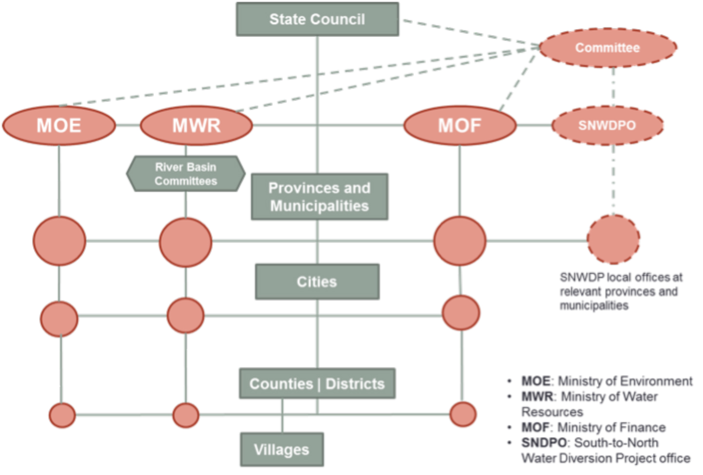
| 08:24, 6 June 2012 | Structure of china govt wang deangelis 2012.jpg (file) |  |
307 KB | Amanda | Political Structure of Chinese Government Developed for Middle Route Project Case Study Rose Wang and Kelly DeAngelis 2012. | 1 |
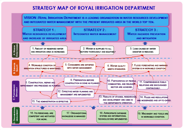
| 13:11, 12 May 2014 | Exhibit2-RID-strategy-map-640x480.png (file) |  |
304 KB | TSP | Exhibit 5b: Strategy Map of Thailand’s Royal Irrigation Department Source: http://www.rid.go.th/ | 1 |
| 09:27, 6 June 2012 | Satellite of MRP region.jpg (file) |  |
285 KB | Amanda | Public Domain Satellite Image Screenshot. Labelled by Rose Wang and Kelly DeAngelis, 2012 | 1 |
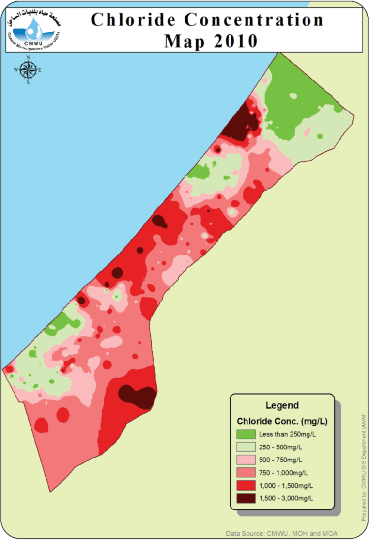
| 13:00, 26 June 2014 | CMWU-2010-chloride.png (file) |  |
280 KB | Amanda | From CMWU Annual Report 2010, Coastal Municipalties Water Utility, Palestine, 2011. Online at: http://www.cmwu.ps/en/yreports.php?view=17 | 1 |
| 09:10, 6 June 2012 | MRP zones image.jpg (file) |  |
271 KB | Amanda | Adapted from Water Pollution Control & Soild and Water Conservation Plan Drafting Committee Water Pollution Control & Soil and Water Conservation Plan of Danjiangkou Reservoir and Upstream. (2005). Base image used without permission under good faith use | 1 |
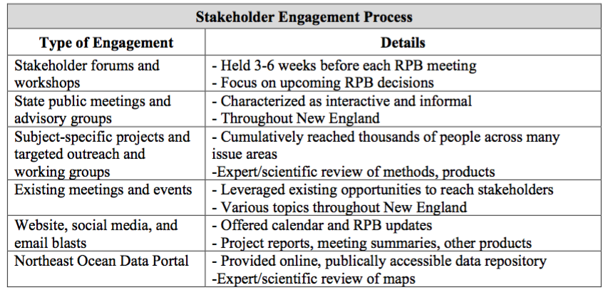
| 11:12, 22 May 2017 | NEPRB Stakeholder Engagement.png (file) |  |
265 KB | Lauren | 1 | |
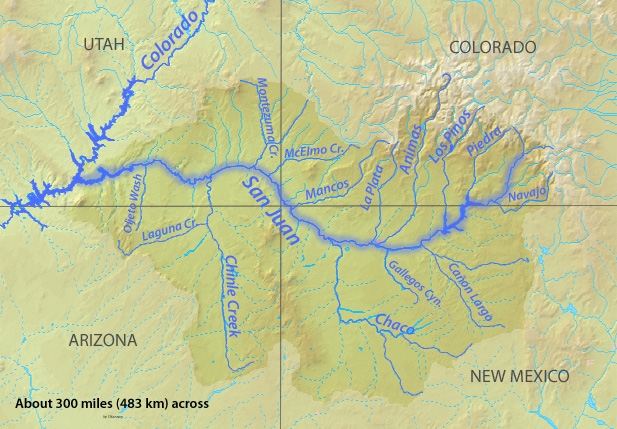
| 00:14, 22 May 2017 | Sanjuanrivermap.jpg (file) |  |
247 KB | Smithgri | Map of San Juan River Basin | 1 |
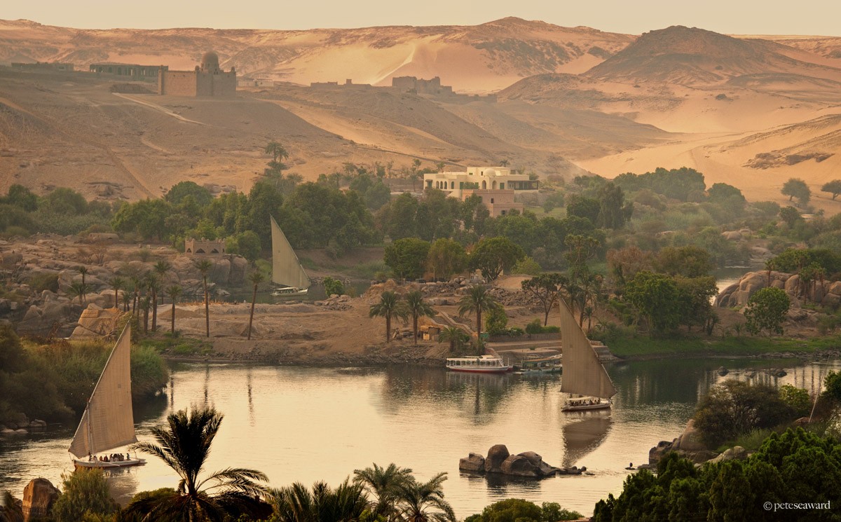
| 17:15, 21 December 2015 | Aswan02.jpg (file) |  |
245 KB | Agustinbotteron | Source:http://www.peteseaward.com/_themes/pete_seaward/watermark.php?photo=110_main_large.jpg&dir=galleries | 1 |
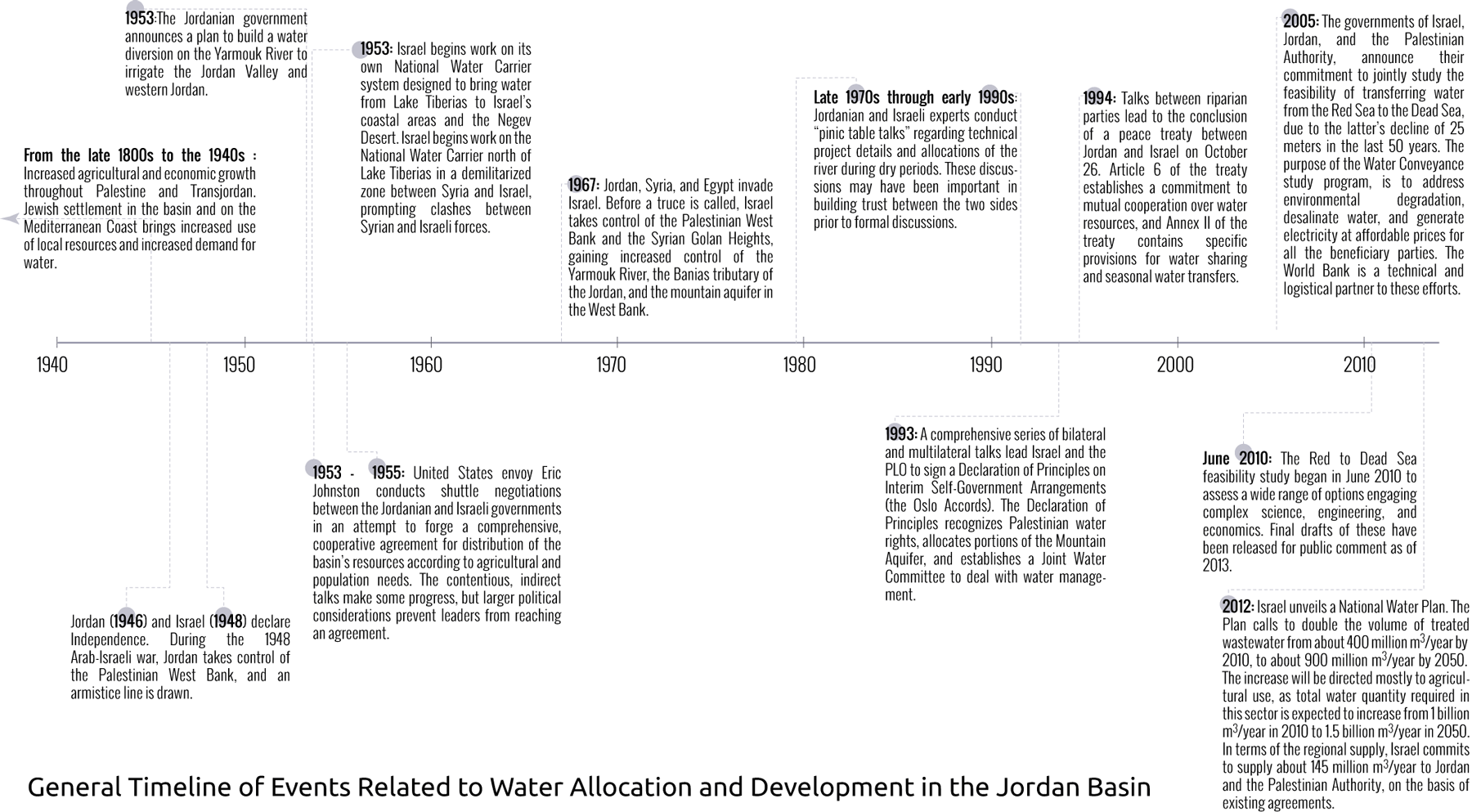
| 14:13, 12 November 2013 | GeneralTimeLineWaterSharingJordanBasin.png (file) |  |
238 KB | Amanda | better resolution | 2 |
| 22:10, 10 May 2014 | Xx-Chaophrayarivermapxx.png (file) |  |
233 KB | TSP | The Chao Phraya River and its Tributaries Source: http://en.wikipedia.org/wiki/Tributaries_of_the_Chao_Phraya_River | 1 |
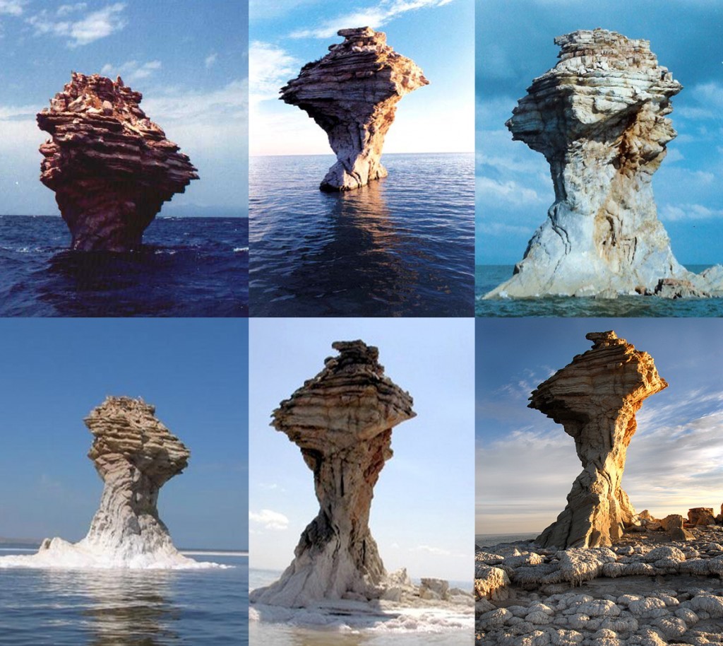
| 10:52, 28 January 2015 | Urmia7.jpg (file) |  |
224 KB | Zarghami | The desiccation of Urmia Lake and its scenic impact (http://www.oxu.ca/lake/, accessed 12-06-2014) | 1 |
| 20:00, 6 June 2017 | Figure 4.PNG (file) |  |
218 KB | Gtbrien | 3 | |
| 13:09, 12 May 2014 | Exhibit1-CPRB-Map-640x480.png (file) |  |
211 KB | TSP | Exhibit 1: The Chao Phraya River and its Tributaries Source: http://en.wikipedia.org/wiki/Tributaries_of_the_Chao_Phraya_River | 1 |
| 09:20, 26 June 2014 | Coastal-Aquifer-Extent.png (file) |  |
210 KB | Amanda | low-res Image showing the extent of the Coastal Aquifer. This image is figure 17 in : Weinberger, G. et al. 2012. The Natural Water Resources between the Meditteranean Sea and the Jordan River. Israel Hydrologic Service. Jerusalem. online: http://www.... | 1 |
| 10:10, 1 November 2017 | Sal6.png (file) |  |
207 KB | SamKumasaka | DIAGRAM: Groundwater Stakeholder Forum, Collaborative Work Group, and Committee Meetings | 1 |
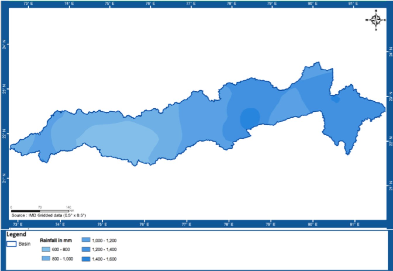
| 21:43, 23 May 2014 | Rainfall.png (file) |  |
207 KB | Rachel | Narmada Basin Annual Average Rainfall | 1 |
| 10:38, 25 May 2017 | -MAP-01 SouthChinaSea MaritimeTerritory-.jpg (file) |  |
205 KB | Pjular | 1 | |
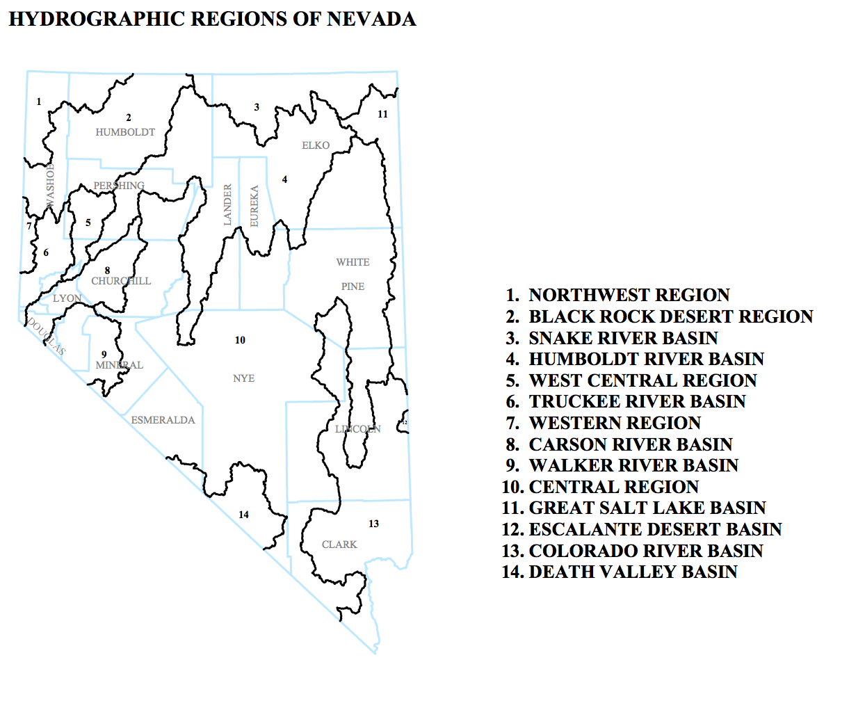
| 14:38, 16 May 2013 | Hydrographic-Regions-of-Nevada.png (file) |  |
203 KB | Amanda | This is an inset from a map entitled "DESIGNATED GROUNDWATER BASINS OF NEVADA" produced by: Department of Conservation and Natural Resources Office of the StateEngineer Division of Water Resources Carson City, Nevada 89701 In addition to the regions sh | 1 |
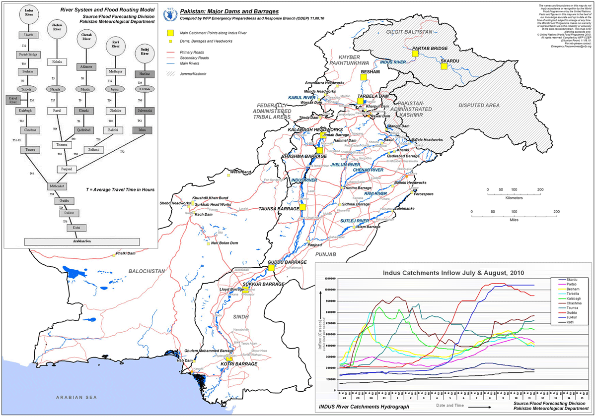
| 15:22, 31 January 2013 | Indus River Pakistan Dams WFP 2010 example.png (file) |  |
202 KB | Amanda | Very low res (screen preview) version of map available from: [http://www.wfp.org/maps/pakistan-major-dams-and-barrages-11-august-2010-high-resolution] or from [http://epmaps.wfp.org/maps/04165_20100812_PAK_A4_ODEP_Pakistan__Major_Dams_and_Barrages,_11 | 1 |
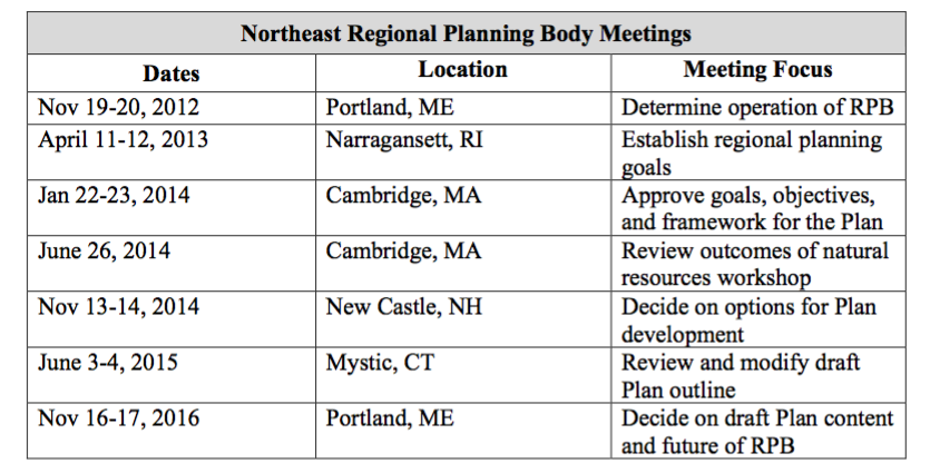
| 11:11, 22 May 2017 | NERPB meetings.png (file) |  |
201 KB | Lauren | 1 | |
| 20:02, 6 June 2017 | Figures 1 and 2.PNG (file) |  |
188 KB | Gtbrien | 4 | |
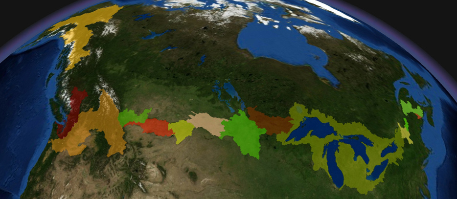
| 13:25, 17 May 2013 | CAN-US-Boundary-Waters.jpg (file) |  |
185 KB | Cvanrees | An image taken from the IJC website mapping transboundary waters and watersheds on the U.S. Canada border. | 1 |
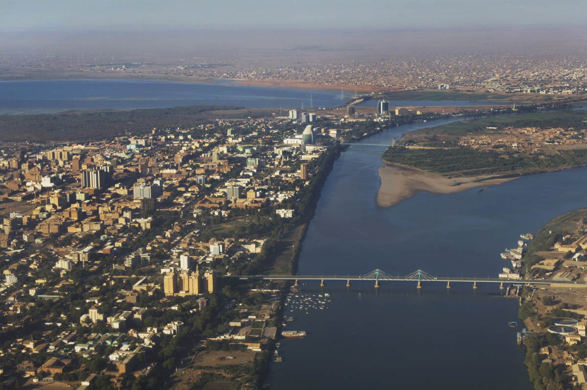
| 17:21, 21 December 2015 | Khartoum02.jpg (file) |  |
184 KB | Agustinbotteron | 1 | |
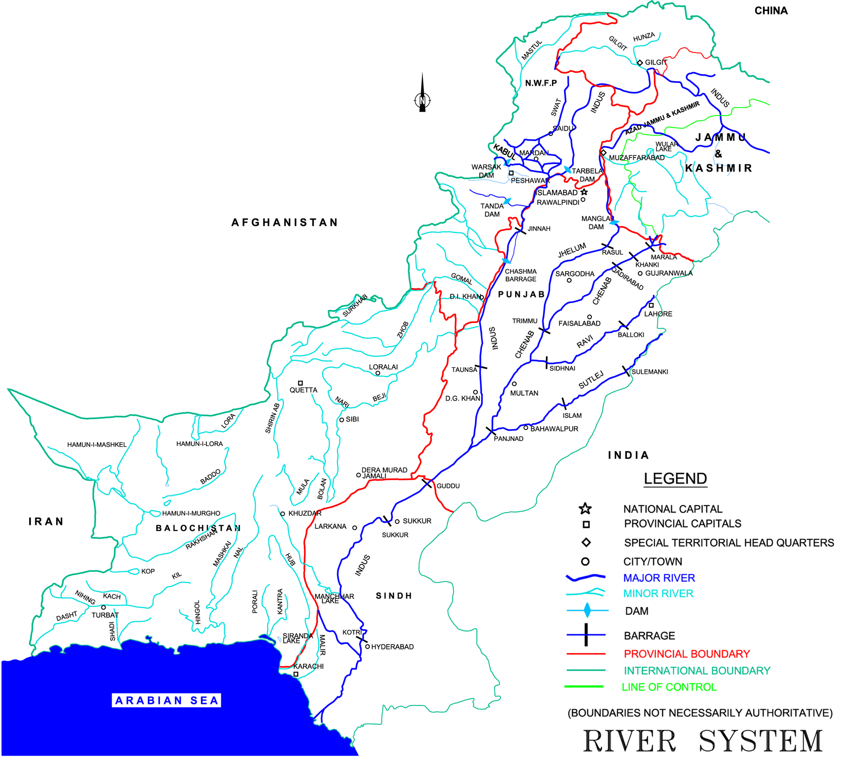
| 08:46, 30 January 2015 | Map of Indus Basin.png (file) |  |
180 KB | Ashfaqm | Map of Indus River Sysetm Figure 2.2 in Ministry of Water and Power. 2002. Pakistan Water Sector Strategy Report v2, p19. Available online: http://waterinfo.net.pk/sites/default/files/knowledge/Pakistan%20Water%20Sector%20Strategy%20-%20Vol%202.pdf | 1 |
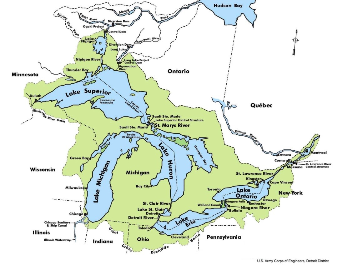
| 18:53, 21 May 2014 | Great Lakes Overview.jpeg (file) |  |
171 KB | B Finney | Taken from the US Army Corp of Engineers website: http://www.lrd-wc.usace.army.mil/LRD-WM/GreatLakes/GreatLakes.html | 1 |
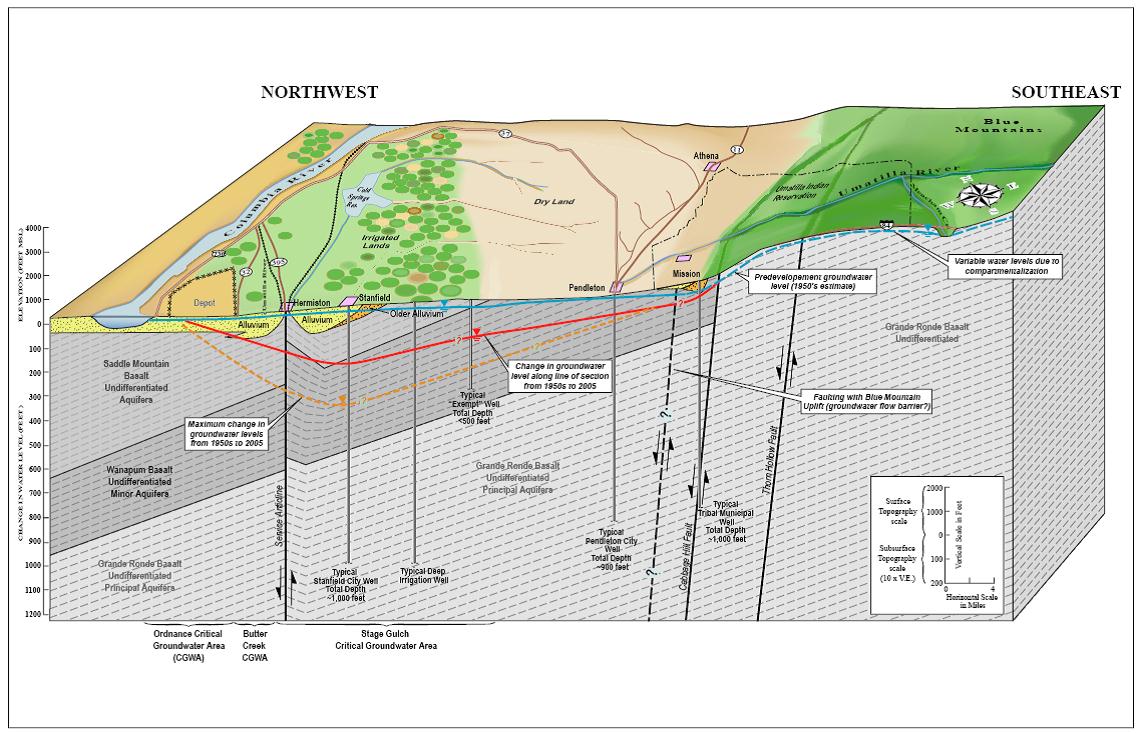
| 11:56, 27 July 2012 | BlockdiagramofUmatillaBasinhydrogeology.jpg (file) |  |
171 KB | Mpritchard | “Product of the Transboundary Freshwater Dispute Database, Department of Geosciences, Oregon State University. Additional information about the TFDD can be found at: <http://www.transboundarywaters.orst.edu>.” | 1 |
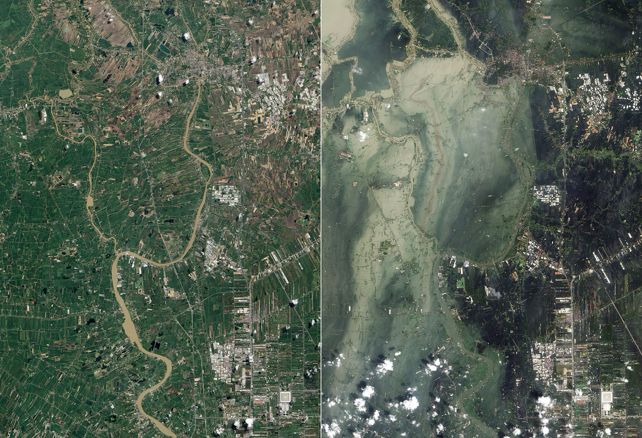
| 22:47, 10 May 2014 | Xx-7.jpg (file) |  |
170 KB | TSP | Satellite photographs showing flooding in Ayutthaya and Pathum Thani Provinces in July 2011 (left, before the flooding October 2011) and October 2011 (right, after the flooding in July) Source: http://en.wikipedia.org/wiki/2011_Thailand_floods | 1 |
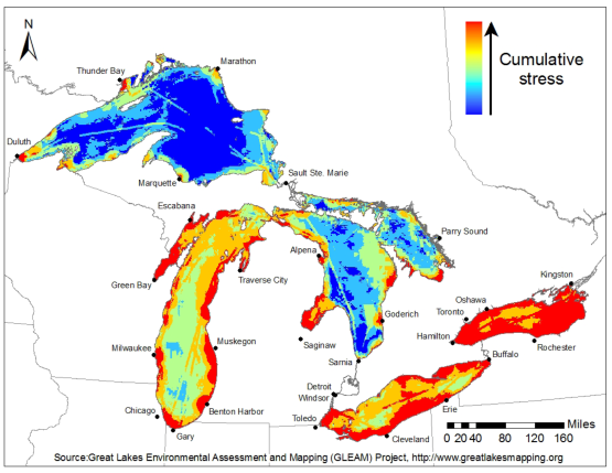
| 11:56, 16 May 2014 | GLEAM Great Lakes Environmental Stress Map.png (file) |  |
169 KB | Amanda | Great Lakes Environmental Stress Map, 2012. This is a product of the Great Lakes Environmental Assessment and Mapping (GLEAM) Project. http://www.greatlakesmapping.org/ Additional maps, descriptive documents, and other resources may be found here: ... | 1 |
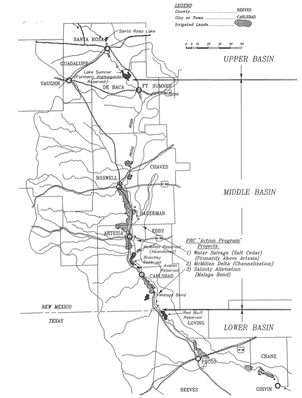
| 19:13, 29 April 2014 | PecosMap.png (file) |  |
163 KB | Mattfitz | A detailed map of the Pecos River Basin in New Mexico from [Kraai, 1993] | 1 |
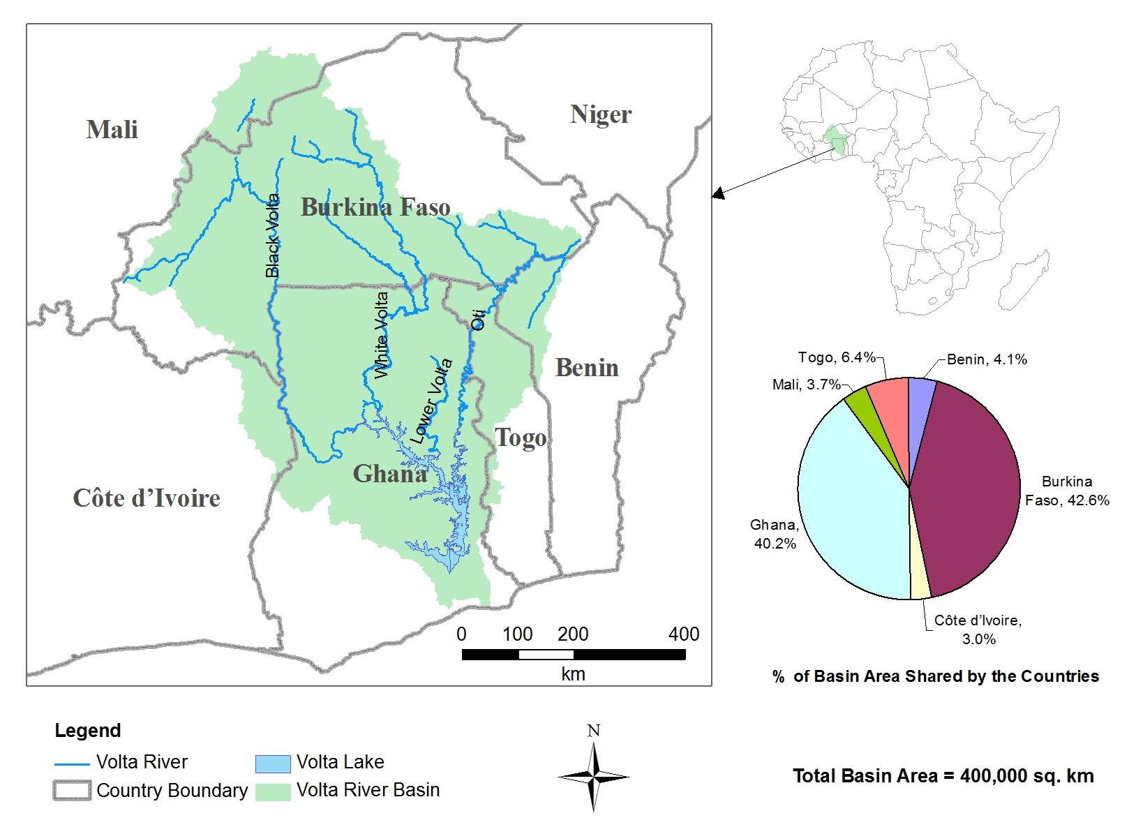
| 19:41, 23 March 2012 | Volta River Basin.jpg (file) |  |
161 KB | Administrator | 1 | |
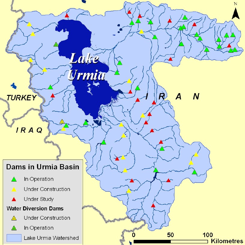
| 10:51, 28 January 2015 | Urmia6.jpg (file) |  |
159 KB | Zarghami | The locations of the dams in operation, construction and investigation (CIWP, 2014) | 1 |
| 20:25, 23 May 2017 | Water Diplomacy Study Casevf.docx (file) | 159 KB | Jimena SG | 1 | ||
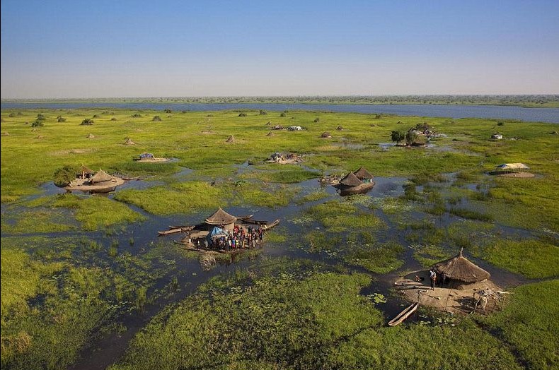
| 17:21, 21 December 2015 | Sudd.jpg (file) |  |
155 KB | Agustinbotteron | 1 | |
| 13:12, 12 May 2014 | Exhibit3-BfAf-Flooding-640x480.jpg (file) |  |
154 KB | TSP | Exhibit 3: Satellite photographs showing flooding in Ayutthaya and Pathum Thani Provinces in July 2011 (left, before the flooding) and October 2011 (right, after the flooding) Source: http://en.wikipedia.org/wiki/2011_Thailand_floods | 1 |
First page |
Previous page |
Next page |
Last page |


