File:Indus River Pakistan Dams WFP 2010 example.png
Summary
Very low res (screen preview) version of map available from:
or from [2]
or from [3]
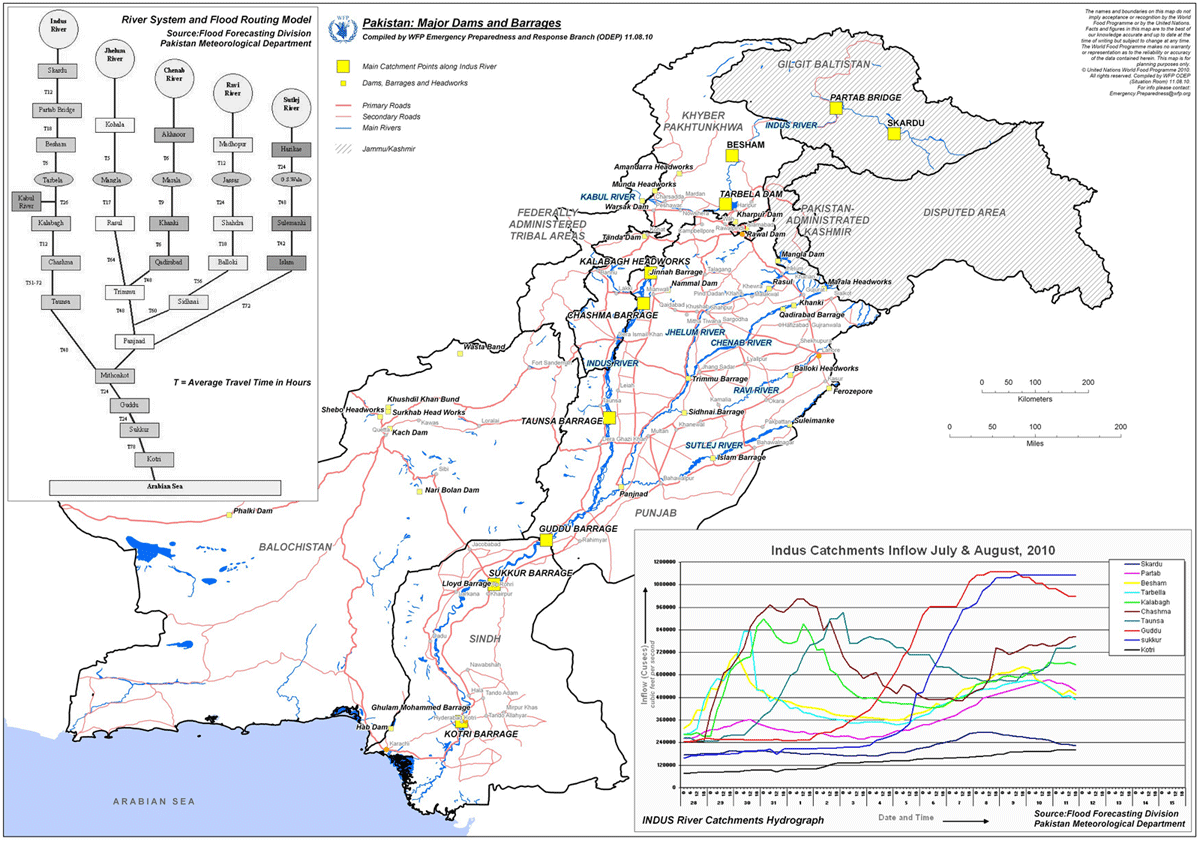
This map was produced by the UN World Food Programme Emergency Preparedness and Response Branch (ODEP) in 2010. We provide this very low res version and hope that users visit the WFP site to view other versions.
Licensing
Files listed as having license "other" do not conform to a standard public domain or creative commons standard.
This may be a file that has been included with the express permission of the creator/owner, or it may be included under the fair-use exclusion. AquaPedia will remove any files which are obviously presented in violation of their copyright, or at the request of the content owner.
Please see the file summary for more info. If you added this file, please annotate the file summary with information about the file and its terms of use and reason it was included.
File history
Click on a date/time to view the file as it appeared at that time.
| Date/Time | Thumbnail | Dimensions | User | Comment | |
|---|---|---|---|---|---|
| current | 15:22, 31 January 2013 | | 1,200 × 841 (202 KB) | Amanda (Talk | contribs) | Very low res (screen preview) version of map available from: [http://www.wfp.org/maps/pakistan-major-dams-and-barrages-11-august-2010-high-resolution] or from [http://epmaps.wfp.org/maps/04165_20100812_PAK_A4_ODEP_Pakistan__Major_Dams_and_Barrages,_11 |
- You cannot overwrite this file.
File usage
The following page links to this file:


