File:Hydrographic-Regions-of-Nevada.png
From AquaPedia Case Study Database
Size of this preview: 726 × 599 pixels. Other resolutions: 727 × 600 pixels | 1,221 × 1,008 pixels.
Original file (1,221 × 1,008 pixels, file size: 203 KB, MIME type: image/png)
Summary
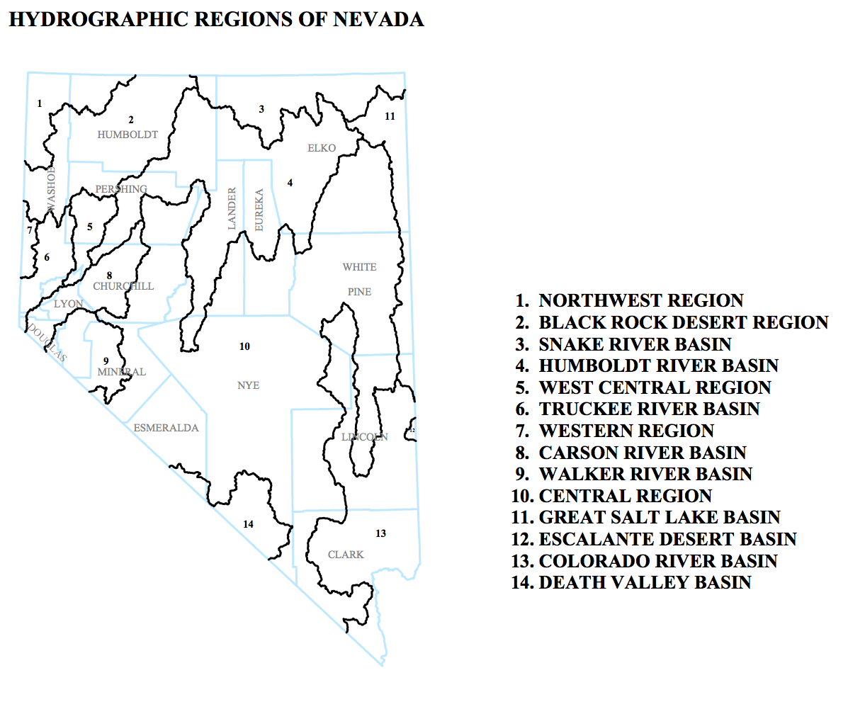
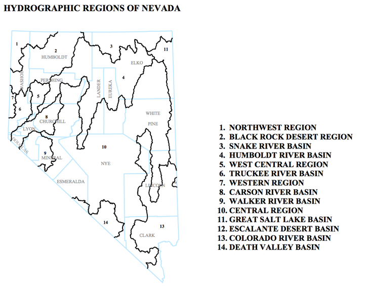
This is an inset from a map entitled "DESIGNATED GROUNDWATER BASINS OF NEVADA" produced by:
Department of Conservation and Natural Resources Office of the StateEngineer Division of Water Resources Carson City, Nevada 89701
In addition to the regions shown here, the map included/listed administrative groundwater basins.
It was accessed May 15 2013 at [1]
The map was originally produced in April 2010
Licensing
This file is considered to be in the public domain. See the file description for any additional details.
File history
Click on a date/time to view the file as it appeared at that time.
| Date/Time | Thumbnail | Dimensions | User | Comment | |
|---|---|---|---|---|---|
| current | 14:38, 16 May 2013 | | 1,221 × 1,008 (203 KB) | Amanda (Talk | contribs) | This is an inset from a map entitled "DESIGNATED GROUNDWATER BASINS OF NEVADA" produced by: Department of Conservation and Natural Resources Office of the StateEngineer Division of Water Resources Carson City, Nevada 89701 In addition to the regions sh |
- You cannot overwrite this file.
File usage
The following page links to this file:


